New Zealand · Stewart Island/Rakiura
Rakiura Track: three days of forest, coast and island logistics
The Rakiura Track combines a multi-day hike with the changing logistics of an island: mandatory bookings, mud, tides and an easy start from Oban.
Conditions described in the guide: confirm current requirements and access with the official source before travelling.
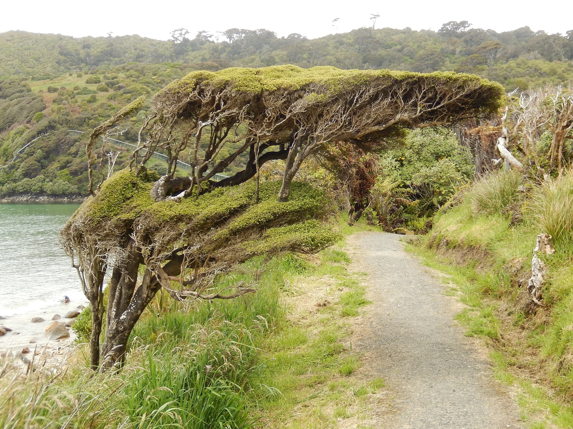
The Rakiura Track is not a route to squeeze hurriedly between two flights. Its circuit links exposed coastline, rimu and kāmahi forest, and the sheltered waters of Paterson Inlet/Whaka a Te Wera on Stewart Island/Rakiura. That variety is the reward, but the trip works best when you separate two decisions: allow plenty of time to reach Oban, and walk at a pace that leaves room to respond to the weather, the terrain and the bookings available.
The key decision: add one night before and one after
Oban, also known as Halfmoon Bay, is the practical base for the route: provisions, accommodation, park information and connections to the track starts are concentrated there. You can arrive by ferry from Bluff or by light aircraft from Invercargill; both journeys depend on conditions and timetables that should be checked before committing to onward connections.
Although the main route is advertised as a three-day hike, booking a night in Oban before setting out reduces the pressure if sea or air transport changes. A second night after finishing prevents the final day from becoming a race for the ferry. This is especially sensible for travellers without a car: from the village, you can walk to Lee Bay, arrange a transfer to the trailhead or, depending on your plan, use a water taxi for certain access points.

A three-stage circuit, with a slower middle day
The usual route links Lee Bay, Port William/Potirepo, North Arm and Fern Gully. From Oban to Lee Bay is approximately 5 km by road; the first section from there to Port William is around 8 km and usually takes three to four hours. It is a good day to settle into the track’s rhythm, cross the coast and approach the remains at Maori Beach.
The 13 km stage between Port William and North Arm is the one that deserves the most time: the official estimate is around six hours, and after prolonged rain some sections can collect mud above boot height. Gaiters, grippy footwear and trekking poles may help, but they do not replace an honest assessment of your own experience. The final stage, from North Arm to Fern Gully, covers about 11 km and usually takes between four and four and a half hours; there will still be roughly 2 km by road to return to Oban.
There is no food for sale along the route, and the huts do not provide emergency food. Carry all your meals, water and a reasonable allowance for delays. Mobile coverage is largely limited to the vicinity of Oban, so an emergency locator device and a plan shared with another person are sensible decisions, not optional extras.
Staying in a hut changes the trip: you must book
Huts and campsites on the Rakiura Track must be booked in advance all year round. Do not treat this hike as a route you can improvise after arriving on the island: first confirm which nights are available, then build your transport around them.
Choose a hut if you prioritise a somewhat lighter pack and simpler overnight logistics; choose a campsite if you prefer sleeping outdoors and already carry suitable equipment. Campsites are not next to the huts and do not entitle you to use their facilities, so they should not be treated as interchangeable alternatives. Fees, cancellation rules, capacity and booking-opening dates change: check them directly before paying.
It is possible to do the route with an operator and guide, which can be useful if you want to delegate part of the logistics. Even so, ask exactly what is included in the transfers, nights, food, equipment and decisions made in bad weather.
Walking on Rakiura also means engaging with its names and stories
Rakiura is not an empty backdrop. The route passes places connected with Māori settlements and provisioning camps, including Port William/Potirepo and Maori Beach. Part of the itinerary crosses Māori land where access has been permitted by its owners; staying on the track, respecting signs and not turning cultural places into photographic props are basic parts of visiting.
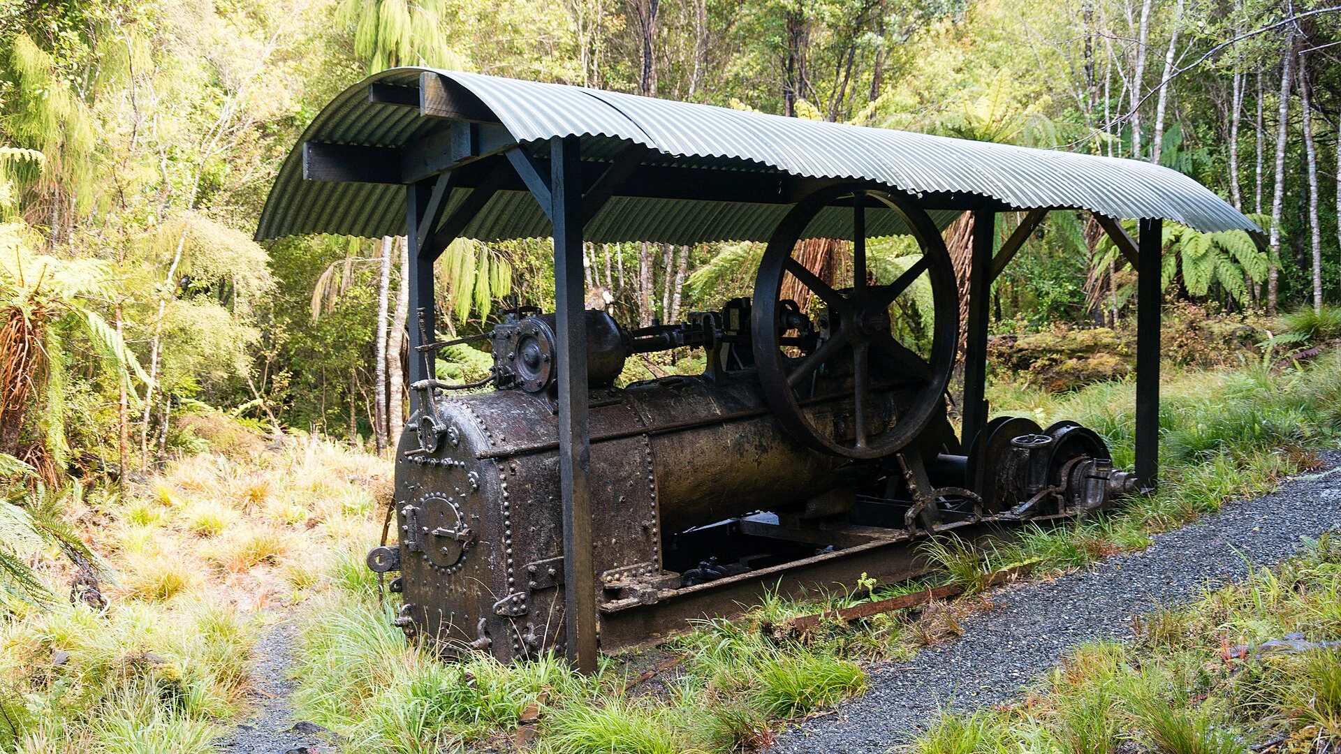
The trail also preserves traces of another island economy: timber tramways, sawmills and an old boiler at Maori Beach. Rather than looking for a single interpretation of the landscape, it helps to understand that forest, coast, resource use and cultural continuity coexist along this stretch of island.
Tītī, or sooty shearwaters, remain culturally important to many Rakiura Māori families on nearby islands. This is not a spectacle visitors should claim for themselves; it is a reminder that living practices and harvesting rights are not reduced to an itinerary stop.
Nocturnal wildlife and weather: observe without forcing an encounter
Birdsong is part of the experience, and Rakiura tokoeka kiwi may be present on the island. If you go out at dusk to listen or look for signs, use a red light or red filter, do not use flash and avoid shining light directly at animals. Seeing kiwi is not guaranteed; responsible walking does not depend on getting that photograph.
Weather can change quickly, with strong winds, hail or rain at any time of year. Some boardwalks and bridges may become impassable during heavy rainfall; in addition, certain water access points depend on the tide. Before starting each stage, check the weather forecast, track conditions and any alerts at the visitor centre. If conditions make it unsafe to continue, waiting or turning back is a normal part of planning.
Who it suits — and when to reconsider
It is a good choice for hikers prepared to carry food and waterproof clothing, spend two nights away from conventional accommodation and adapt their plan to an island with limited transport. It is also feasible without a private vehicle, provided you book track accommodation in advance and leave time to spare in Oban.
It may not suit you if you are looking for consistently firm ground, continuous coverage, a rigid itinerary or guaranteed accessibility. The deep mud, steps and slippery surfaces described along the route mean that anyone travelling with mobility, balance or support needs should request specific information. Do not assume that a great-walk category is the same as an easy stroll.
References to check before departure
- New Zealand Department of Conservation: hut and campsite bookings, alerts, Rakiura Track conditions, maps, forecasts and visitor-centre services.
- Tourism New Zealand: general arrival options for Stewart Island/Rakiura and guidance on Oban.
- Te Rūnanga o Ngāi Tahu and the park’s cultural materials: historical and cultural context for Rakiura, Port William/Potirepo, Maori Beach and the tītī islands.
- Your chosen ferry operator or airline: timetables, baggage, weather conditions, changes and cancellations.
References consulted during editorial review. Times, requirements and advisories may change: always confirm with the official source.
- https://www.doc.govt.nz/rakiuratrackwww.doc.govt.nz
- https://www.doc.govt.nz/rakiuratrack?activity=walking-tramping®ion=southlandwww.doc.govt.nz
- https://www.doc.govt.nz/parks-and-recreation/places-to-go/online-bookings/?sg=RAT&sgn=Rakiura+Track+-+Great+Walkwww.doc.govt.nz
- https://www.doc.govt.nz/documents/parks-and-recreation/tracks-and-walks/southland/rakiura-track-brochure.pdfwww.doc.govt.nz
- https://dxcprod.doc.govt.nz/globalassets/documents/parks-and-recreation/tracks-and-walks/southland/rakiura-track-guide.pdfdxcprod.doc.govt.nz
- https://www.doc.govt.nz/documents/parks-and-recreation/tracks-and-walks/southland/stewart-island-rakiura-short-walks-brochure.pdfwww.doc.govt.nz
- https://www.doc.govt.nz/globalassets/documents/parks-and-recreation/tracks-and-walks/southland/stewart-island-rakiura-short-walks-brochure.pdfwww.doc.govt.nz
- https://www.doc.govt.nz/rakiurawww.doc.govt.nz
- Nueva ZelandaWikidata · CC0 1.0 · Wikidata · Q664
- Nueva ZelandaWikidata · CC0 1.0 · Wikidata · Q99292883
- Nueva ZelandaWikidata · CC0 1.0 · Wikidata · Q20288890
- New ZealandWorld Countries — mledoze · ODbL 1.0 · World countries dataset by mledoze and contributors · ODbL 1.0
- New ZealandWorld Bank Open Data · CC BY 4.0 · World Bank
- turismo regenerativo en la planificación turística regional de Nueva ZelandaCrossref · Metadatos públicos; derechos específicos por campo cuando correspondan · Crossref
- Turismo cinematográfico en Nueva Zelanda: Hobbiton Movie Set como estrategia inversaCrossref · Metadatos públicos; derechos específicos por campo cuando correspondan · Crossref
- Desempeño relativo de la productividad física de la ganadería de Nueva Zelanda y Uruguay, 1870-2010. ANEXOCrossref · Metadatos públicos; derechos específicos por campo cuando correspondan · Crossref
- Desempeño relativo de la productividad física de la ganadería de Nueva Zelanda y Uruguay, 1870-2010Crossref · Metadatos públicos; derechos específicos por campo cuando correspondan · Crossref
- Nueva ZelandaCrossref · Metadatos públicos; derechos específicos por campo cuando correspondan · Crossref