Albania · Vjosa Valley
Albania’s Vjosa Valley between Përmet, Këlcyrë and Tepelenë
The best way to understand the Vjosa is not to string together rafting, canyon trips and riverside photos. Choose one stretch, sleep nearby and accept that a free-flowing river calls for slower, more flexible, low-impact plans.
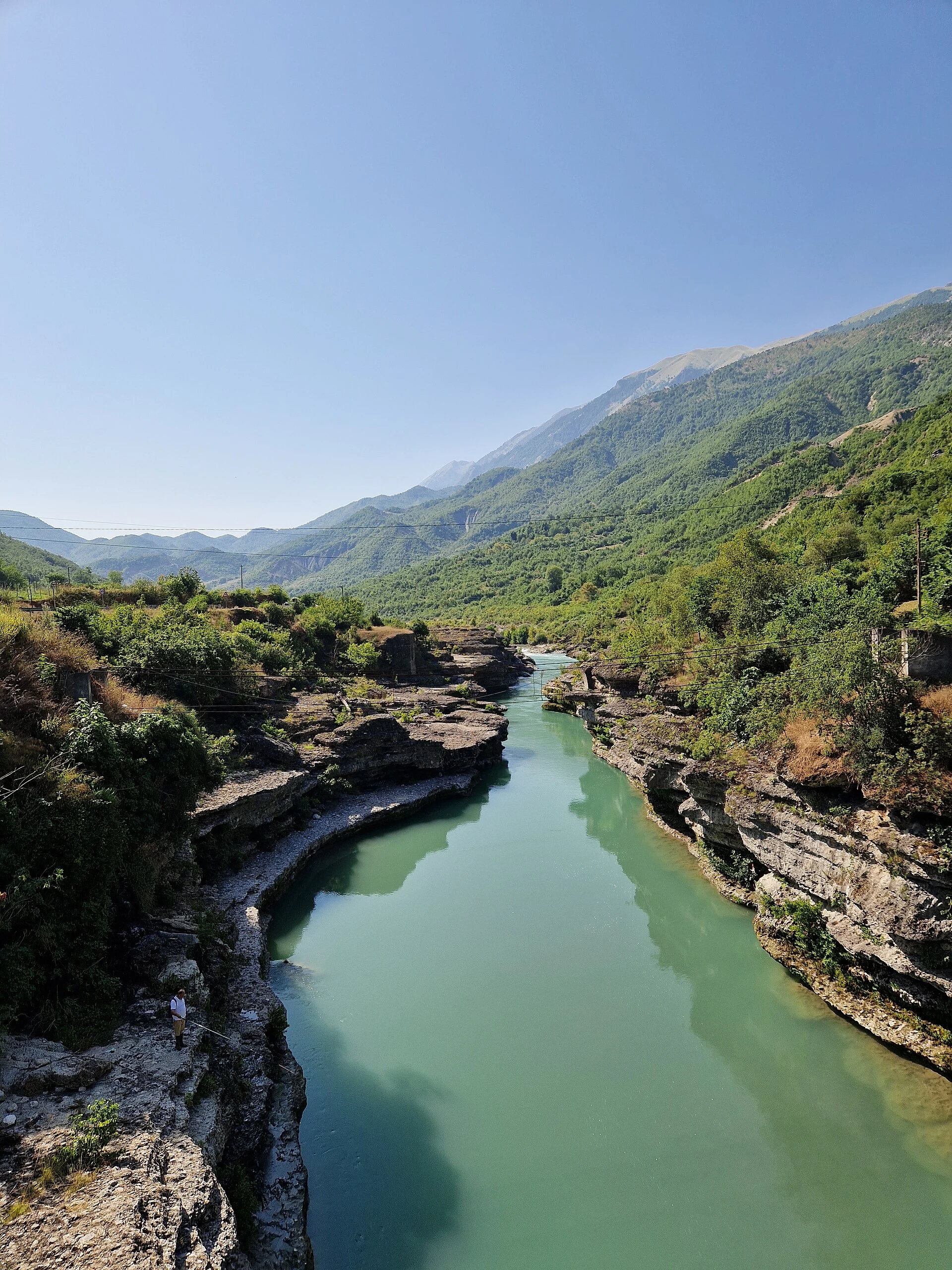
The Vjosa is not one continuous backdrop or a single attraction. It rises in the Pindus Mountains in Greece, enters Albania near Çarshovë, passes through the area around Përmet, Këlcyrë and Tepelenë, and reaches the Adriatic in the Vlorë area. Its free-flowing channel creates gorges, braided channels, gravel bars, riparian forests and wetlands: landscapes that cannot be summed up by a single excursion. The national park was declared in 2023, and since 2025 the valley has been part of UNESCO’s World Network of Biosphere Reserves.
For a three- to five-day trip, the useful question is not “Where can I go rafting?” but what kind of relationship you want with the river: valley life and tributaries around Përmet, the enclosed scale of the gorge at Këlcyrë, or the confluences and broader river landscape around Tepelenë. Choosing one base—or two at most—reduces transfers and avoids treating a living ecosystem as a checklist of stops.
Listen to Albania
A documented soundscape that complements this guide to Albania. The best way to understand the Vjosa is not to string together rafting, canyon trips and riverside photos. Choose one stretch, sleep nearby and accept that a free-flowing river calls for slower, more flexible, low-impact plans.
Audio by No machine-readable author provided. Luke Bales~commonswiki assumed (based on copyright claims). · Wikimedia Commons · CC BY-SA 3.0 · Duration: 01:35
Choose a stretch first; activities come second
Përmet works well if you want to combine the Vjosa valley with a walkable town and the landscapes of Langarica and Bënja. It is important to distinguish them: the Bënja thermal springs and Langarica Canyon are on the Langarica River, not on the main channel of the Vjosa. They are a good complement for travellers who want to alternate river, mountain and local heritage, but they do not replace observing the Vjosa.
Këlcyrë is a place to understand how the valley narrows: the gorge is the reason to stop, walk slowly and watch the river pass through a gap between steep-sided hills. This is a more landscape-focused than urban choice; do not turn it into a few-minute stop between two destinations.
Tepelenë makes sense if you are interested in the geography of water: the Vjosa and Drino meet there. It can be a practical base for observing the transition from a more enclosed valley to broader plains and channels, without trying to cover the river mouth on the same day.
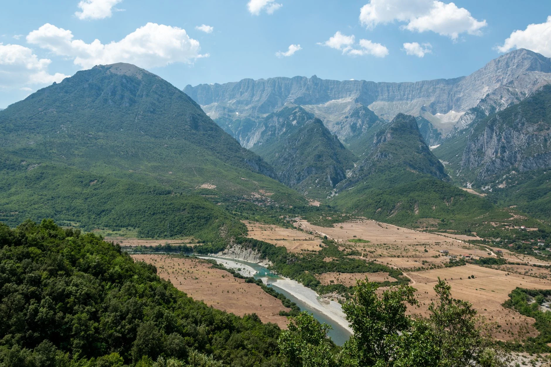
A slow four-day itinerary without chasing the entire river
Day 1: arrive in Përmet and get your bearings. Spend the afternoon in town, using its services and taking an initial look at the valley. Before booking activities, ask your accommodation about the actual condition of access roads and about authorised operators: river and road conditions matter more than a plan made from afar.
Day 2: keep the Vjosa and Langarica distinct. Visit Bënja and Langarica as a tributary landscape, leaving enough time to return to Përmet without forcing in a second excursion. The thermal springs are a popular natural site, not a spa with guaranteed facilities: check access and local conditions on the day.
Day 3: a short transfer and an overnight stay in Këlcyrë. Make the gorge the focus of the day. Rather than looking for the closest photo spot by the riverbank, observe from existing access areas and leave room for a meal, a conversation or a short walk. The value of this stretch lies precisely in its scale, not in accumulating adrenaline.
Day 4: Tepelenë and the confluence. Continue to Tepelenë to understand that the river does not end where the gorge does. If you have an extra day, use it for a second night at the same base or to continue towards the lower stretch—not to add more road kilometres to an already full schedule.
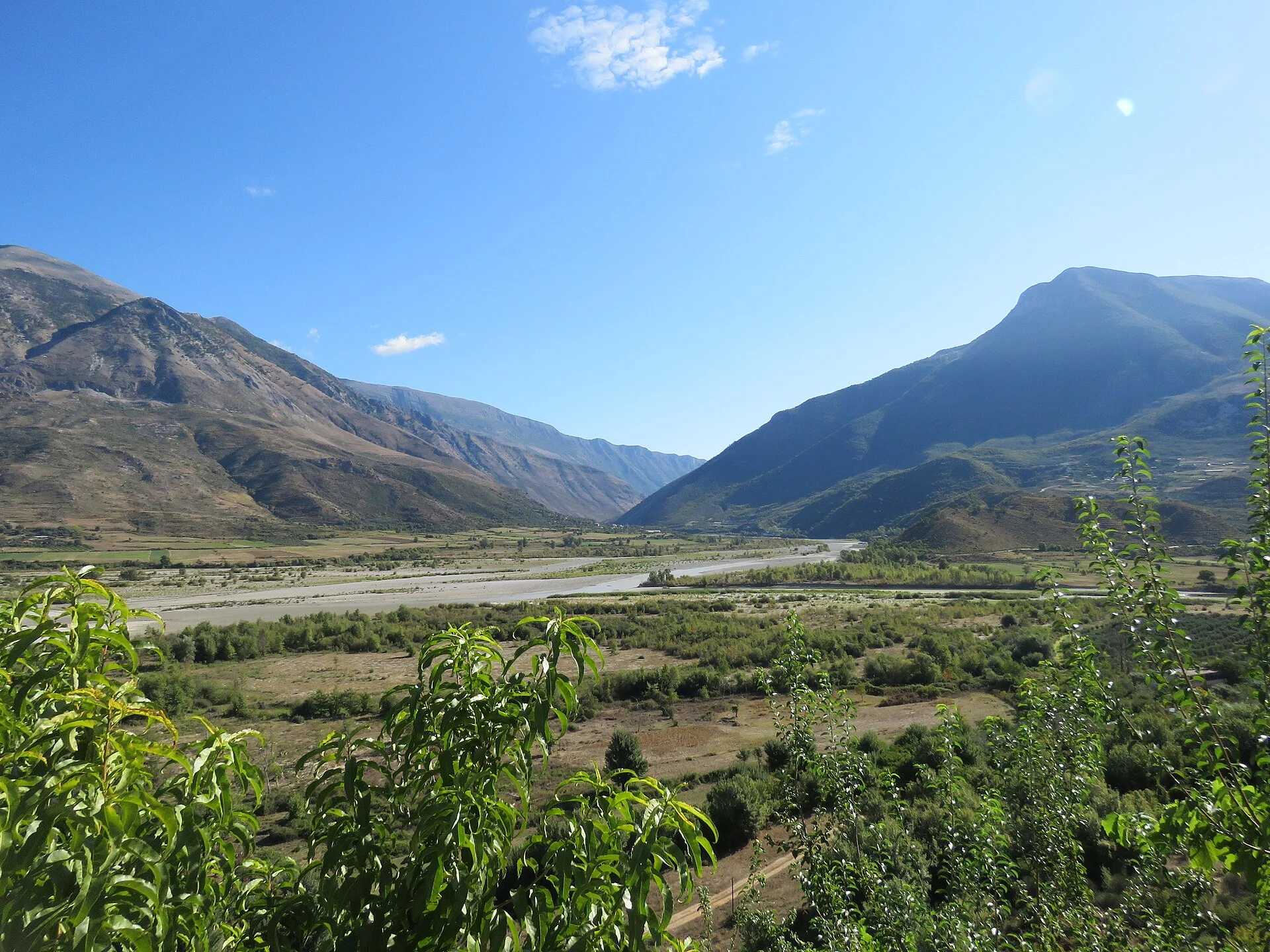
Rafting: an option, not the point of the trip
The park’s management plan treats rafting as a regulated activity: companies operating on the Vjosa and its tributaries must hold an official concession. It also sets guidelines to keep away from riverbanks, gravel bars and shallow sensitive areas, where wildlife may breed or rest. When choosing an outing, therefore, ask specifically who operates it, which stretch it uses and how the activity is adapted to park rules; do not book on the basis of photographs or promises of a “wild river” alone.
For canoes, kayaks and other non-motorised craft, the National Agency of Protected Areas indicates that authorisations may be required depending on the proposal and location. Do not arrange an independent river trip without prior confirmation from the administration of Vjosa River National Park.
If you do not want to go rafting, the trip still makes perfect sense. Vjosa’s value lies in the way floods, channels, islands and sediment continually reshape the landscape. Walking, watching birds from a distance, sitting beside a well-used stretch without encroaching on the riverbank, and supporting local accommodation or food businesses are more compatible with that changing nature.
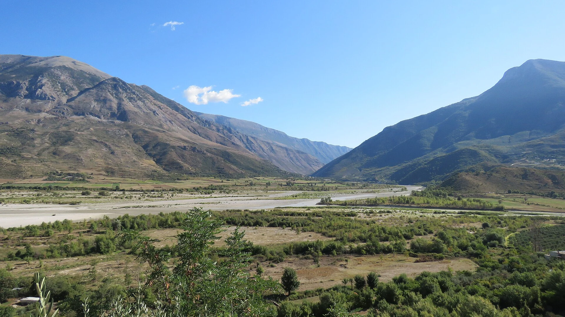
How to be beside the water without taking it over
A free-flowing river is not a linear swimming pool. Avoid cutting new paths to the riverbank, crossing sand or gravel bars for a photograph, entering riparian woodland or leaving waste, including food scraps. The management plan prohibits leaving paths or designated areas in sensitive zones and asks people to keep their distance from the banks while navigating, so as not to affect habitats and birds.
Swimming may be possible privately, on a non-commercial, small-scale basis, but this should not be understood as a universal invitation: the plan itself provides for monitoring bathing spots and introducing further restrictions if impacts are detected. Choose places already in use, set nothing up, do not bring amplified music, and turn back if the water, access or presence of wildlife suggests that entering would be unwise.
Accessibility is uneven. Riverbanks, gorges and access routes to the springs may involve loose stone, uneven ground, mud or steps; a view from the road or village may be a better choice than trying to reach the water’s edge. Before booking, ask each accommodation provider or operator for specific information about surfaces, steps, adapted toilets, parking distance and the possibility of cancelling if weather conditions change. This information should be checked directly with the establishment or park administration.
The logistics best left open
The valley is better suited to travelling by road than to relying on a rigid chain of connections. If you are not driving, do not assume there will be frequent public transport between every village, or that you will be able to return the same day after an activity in a rural area: confirm timetables and departure points locally before committing to non-refundable bookings.
There is no universal “best” season for the Vjosa. Water levels, navigability, heat, roadworks and access conditions change. Before setting out, check information from the National Agency of Protected Areas and the park administration; for commercial activities, also confirm that the provider still holds the relevant authorisation. Protecting the park takes priority over the planned experience.
References consulted during editorial review. Times, requirements and advisories may change: always confirm with the official source.
- https://akzm.gov.al/regjistri-i-kerkesave-dhe-pergjigjeve-2026/akzm.gov.al
- https://akzm.gov.al/wp-content/uploads/2020/07/Chapter-A.-Management-Plan.pdfakzm.gov.al
- https://akt.gov.al/natyre/parku-kombetar-i-lumit-te-eger-vjosa/akt.gov.al
- https://planifikimi.gov.al/index.php?L=2&id=126planifikimi.gov.al
- https://akzm.gov.al/regjistri-i-kerkesave-dhe-pergjigjeve-2025/akzm.gov.al
- https://www.kryeministria.al/en/newsroom/parqet/www.kryeministria.al
- https://www.vjosanationalpark.al/www.vjosanationalpark.al
- https://www.vjosanationalpark.al/aboutwww.vjosanationalpark.al
- AlbaniaWikidata · CC0 1.0 · Wikidata · Q222
- AlbaniaWikidata · CC0 1.0 · Wikidata · Q1655535
- AlbaniaWikidata · CC0 1.0 · Wikidata · Q1576577
- AlbaniaWorld Bank Open Data · CC BY 4.0 · World Bank
- AlbaniaDBpedia · CC BY-SA 3.0 · DBpedia