Ifugao’s terraces through Batad, Bangaan and Kiangan
The rice terraces of the Cordillera are not one single “Banaue landscape.” Choosing between Batad, Bangaan and Kiangan changes the physical demands, travel time and, above all, how you understand an agricultural system that still depends on water, forest, labour and community.
The first good decision when planning a trip to Ifugao is to stop looking for “the Banaue terraces” as though they were one attraction. The UNESCO inscription brings together five clusters in four municipalities: Batad and Bangaan are in Banaue; the others are Mayoyao Central, Hungduan and Nagacadan, in Kiangan. They are cultivated rice fields, settlements and water catchments—not one continuous backdrop or a theme park.
For a short trip, the most useful question is not how many viewpoints you can collect, but what relationship you want to have with the terrain: Batad requires going down and climbing back up; Bangaan makes it easier to understand the relationship between village and terraces; Kiangan adds historical and museum context. Leave room for rain, changing access conditions and agricultural rhythms: in a living landscape, the colour of the rice should not be your only criterion.
Visual context for PhilippinesContext video selected for this guide; it does not by itself identify every place mentioned.Video by Sergey Guk · Pexels · Pexels License · Duration: 00:16
♫
Listen to Philippines
A documented soundscape that complements this guide to Philippines. The rice terraces of the Cordillera are not one single “Banaue landscape.” Choosing between Batad, Bangaan and Kiangan changes the physical demands, travel time and, above all, how you understand an agricultural system that still depends on water, forest, labour and community.
Cultural or ambient audio selected as context; it does not necessarily represent every place mentioned. Audio by kevp888 · Openverse · CC BY 4.0 · Duration: 03:4901
Before you leave: name what you are going to see accurately
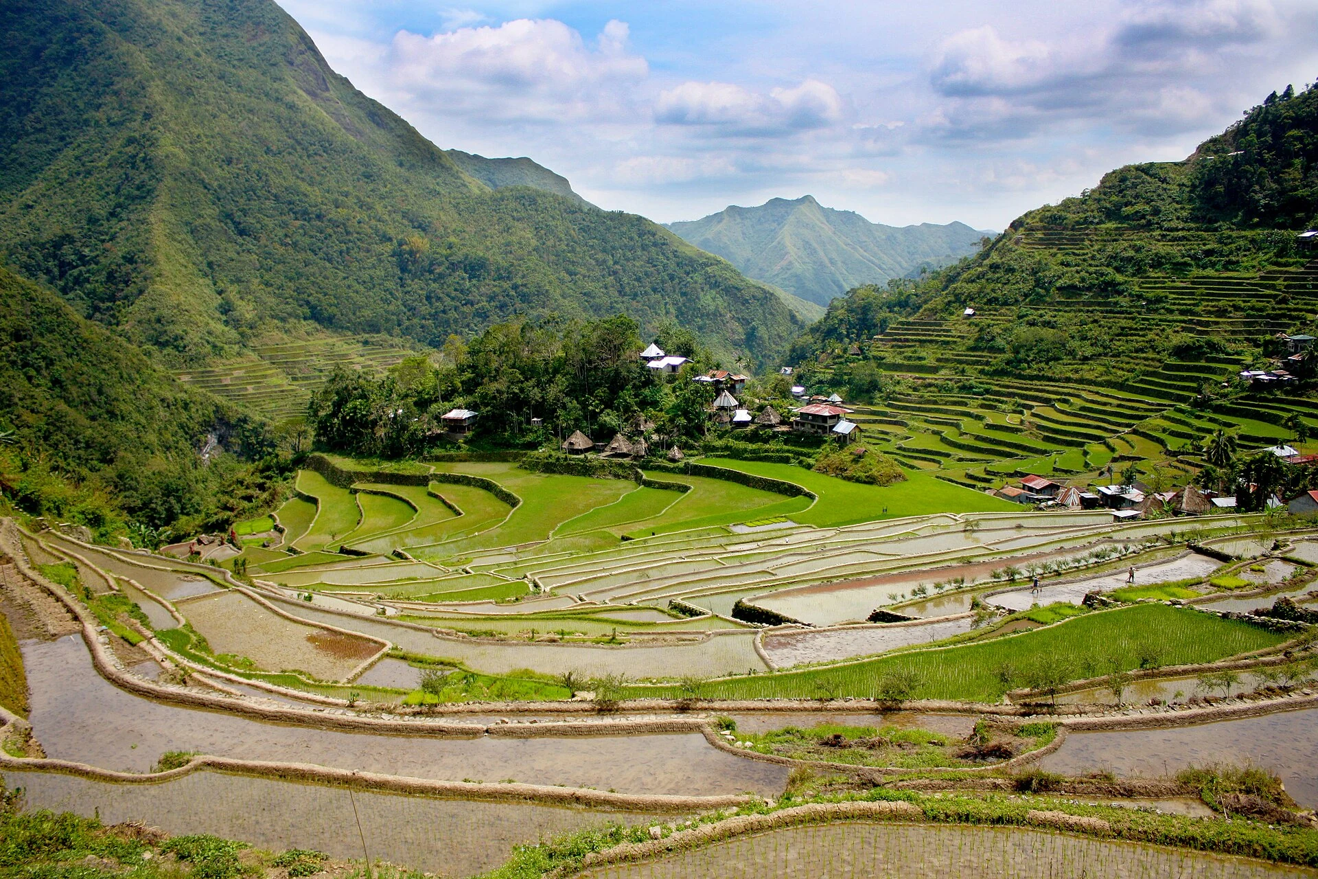
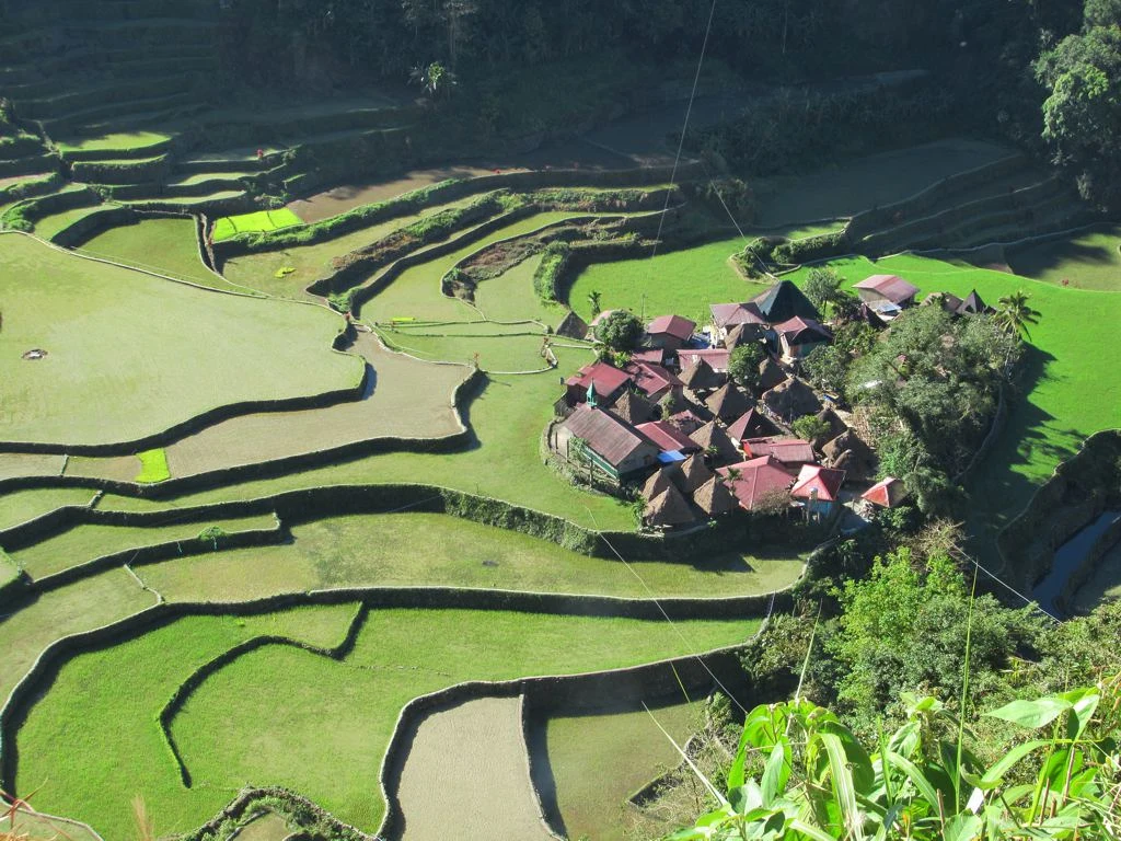
Batad and Bangaan are part of the UNESCO-inscribed property, but they do not represent all the terraces of Ifugao. Batad is recognised for its semicircular amphitheatre, with the village at the bottom; Bangaan is characterised by terraces framing a traditional village. Mayoyao Central combines rice fields with bale houses and alang granaries; Nagacadan is arranged in two ascending bands separated by a river; and Hungduan displays a pattern that UNESCO compares to a spider’s web.
This distinction matters in practice: a viewpoint near Banaue may be a good visual introduction, but it does not automatically mean you have visited one of the five inscribed clusters. If your time is limited, choose one cluster and give yourself time to walk through it, observe the water, walls and village, rather than stringing together photo stops.
Choose Batad if you accept that the landscape must be earned on foot
Batad is the right choice for anyone who wants to understand the scale from within and is prepared for a route with steep elevation changes, stone steps and terrain that can become slippery. The official tourism guide describes access from the place known as The Saddle, followed by a descent on foot to the village; it also warns that the route to Tappiya Falls includes a steep descent and a demanding climb back up.
The trade-off: Batad is not a comfortable out-and-back visit if you arrive tired after a long journey. Spending the night in the village can spread out the effort and prevent the hike from becoming a race against transport, but services are more basic than in Banaue. If you go, bring grippy footwear, water, rain protection and cash; confirm trail conditions, local registration, available guides and any restrictions on the day with the tourism office or community. The national guide itself notes that weather, permits and access policies can change.
Do not step onto the terraces or their walls to improve a photograph. They are fragile, privately managed agricultural infrastructure: an edge is not a footpath.
Choose Bangaan if you want to read the village before conquering the climb
Bangaan is the better alternative for travellers who would rather focus on the relationship between homes, rice fields and hillside, without assuming that the experience must culminate in a waterfall or the most physically demanding route. UNESCO identifies this cluster precisely through the terraces that form the backdrop to a traditional Ifugao village.
That does not make it an “easy” or interchangeable version of Batad: slopes, steps, weather and access still require caution. It simply poses a different travel question: less trail epic, more attention to how a community inhabits a productive landscape. Allow time to walk slowly, ask before photographing homes or people, and use locally provided services without treating everyday life as a performance for visitors.
For many people, a sensible combination is Bangaan as a slow reading of the system and Batad only if fitness, time and trail conditions allow it. You lose nothing by skipping Tappiya Falls: the terraces are not scenery for a waterfall hike.
Add Kiangan so the trip is not reduced to landscape
Kiangan offers a useful third layer for a three- to five-day itinerary. It is home to the National Museum Cordillera, within the grounds of the Kiangan Memorial Shrine. The museum preserves materials linked to Ifugao material culture—including farming and fishing tools, household objects, parts of a house and bulul granary figures—and serves as a site museum for the inscribed terraces.
The museum should not be presented as a key that completely “explains” present-day communities. It can, however, help you arrive at Batad or Bangaan with better questions: what relationship exists between grain, granary, house, water and kinship? Why is looking at the stone wall not enough? Check opening hours, guided visits and access conditions directly with the museum before travelling, as these details may change.
05
Look at the whole system: rice field, forest and water
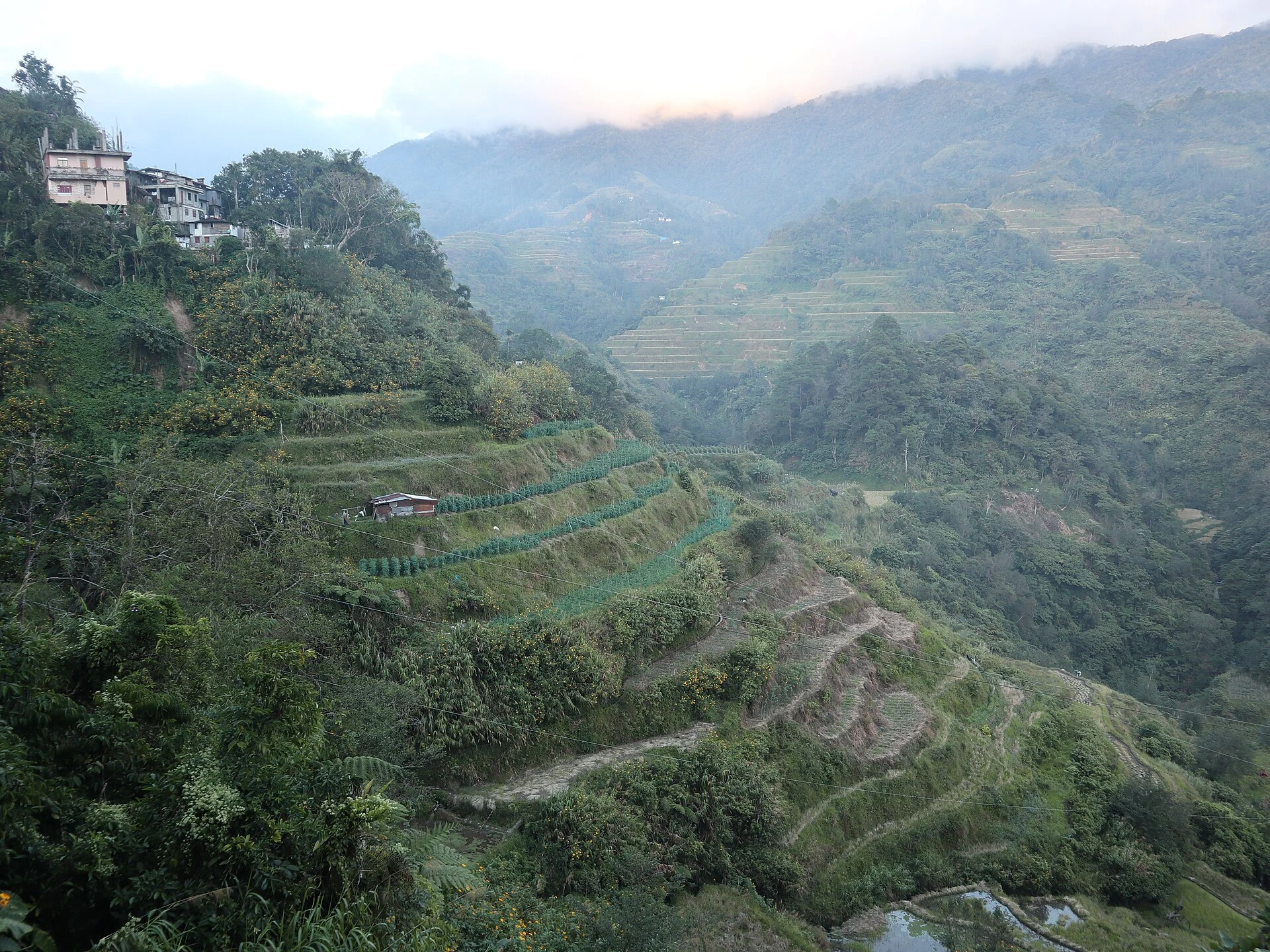
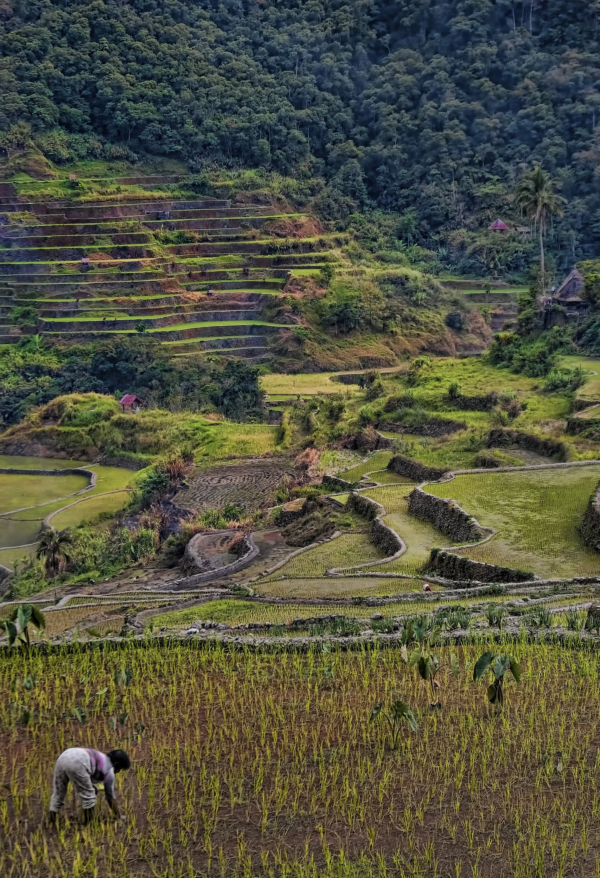
FAO has recognised the Ifugao Rice Terraces as a Globally Important Agricultural Heritage System since 2011. It describes a system made up of tree groves and communal forest, crops, terraces, settlements, water bodies and irrigation; upland forests help regulate the water reaching the rice fields.
That is why calling the terraces an ancient engineering feat is insufficient if present-day maintenance and labour are left out. UNESCO warns of vulnerabilities linked to labour shortages, social change, climatic shifts and problems affecting water sources. Responsible visiting does not mean declaring the place “sustainable” because of its age. It means not adding pressure to trails and crops, following community guidance, taking neither plants nor stones, reducing waste and not using drones without explicit consent.
06
A practical decision in three questions
Do you have strong knees, plenty of time and a genuine desire to walk? Consider Batad, without adding other demanding visits on the same day.
Do you want a calmer cultural approach that is less focused on a major hike? Prioritise Bangaan and spend time in the village and learning its local rules.
Do you want context for what you are seeing, or are you travelling with limited mobility? Base the day around road-accessible viewpoints and Kiangan; do not assume that paths between terraces are suitable for independent reduced-mobility access. Batad’s uneven steps and slopes make it unsuitable for everyone.
In every case, check transport, rain, landslides, registration and the availability of local accompaniment before setting out, using official or community sources. The best itinerary here is not the one that promises to see everything; it is the one that leaves room for the landscape to remain a place of work and life.
Sources and checks
References consulted during editorial review. Times, requirements and advisories may change: always confirm with the official source.