Mauritius · cultural landscape and memory
Le Morne in Mauritius, from mountain trail to living memory
Le Morne Brabant is one of Mauritius’s most photographed landscapes, but its importance does not depend on getting as high as possible. This guide helps you decide whether to explore the lower section, tackle the exposed route with proper preparation or devote your visit to the memorial sites at the foot of the mountain.
Conditions described in the guide: confirm current requirements and access with the official source before travelling.
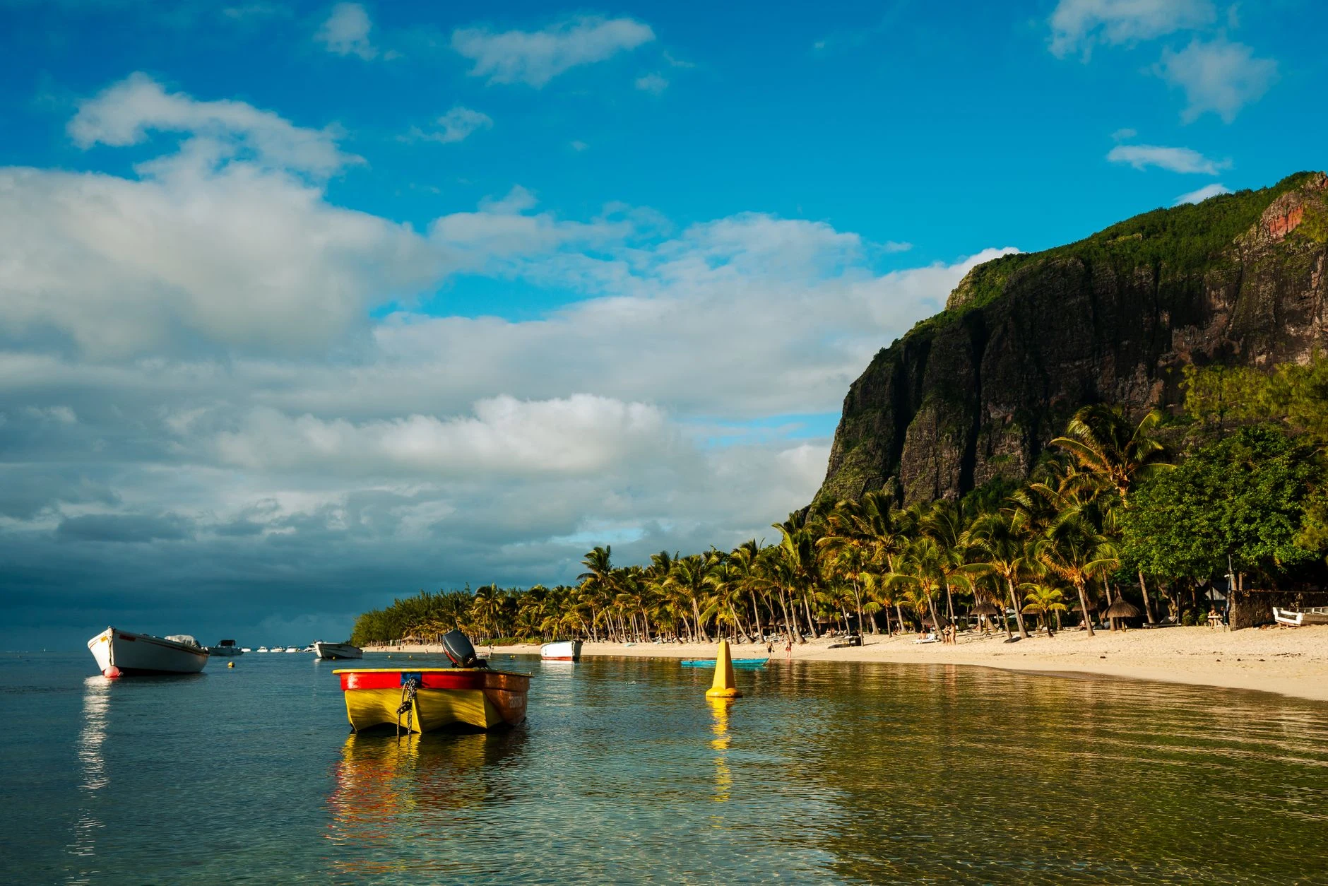
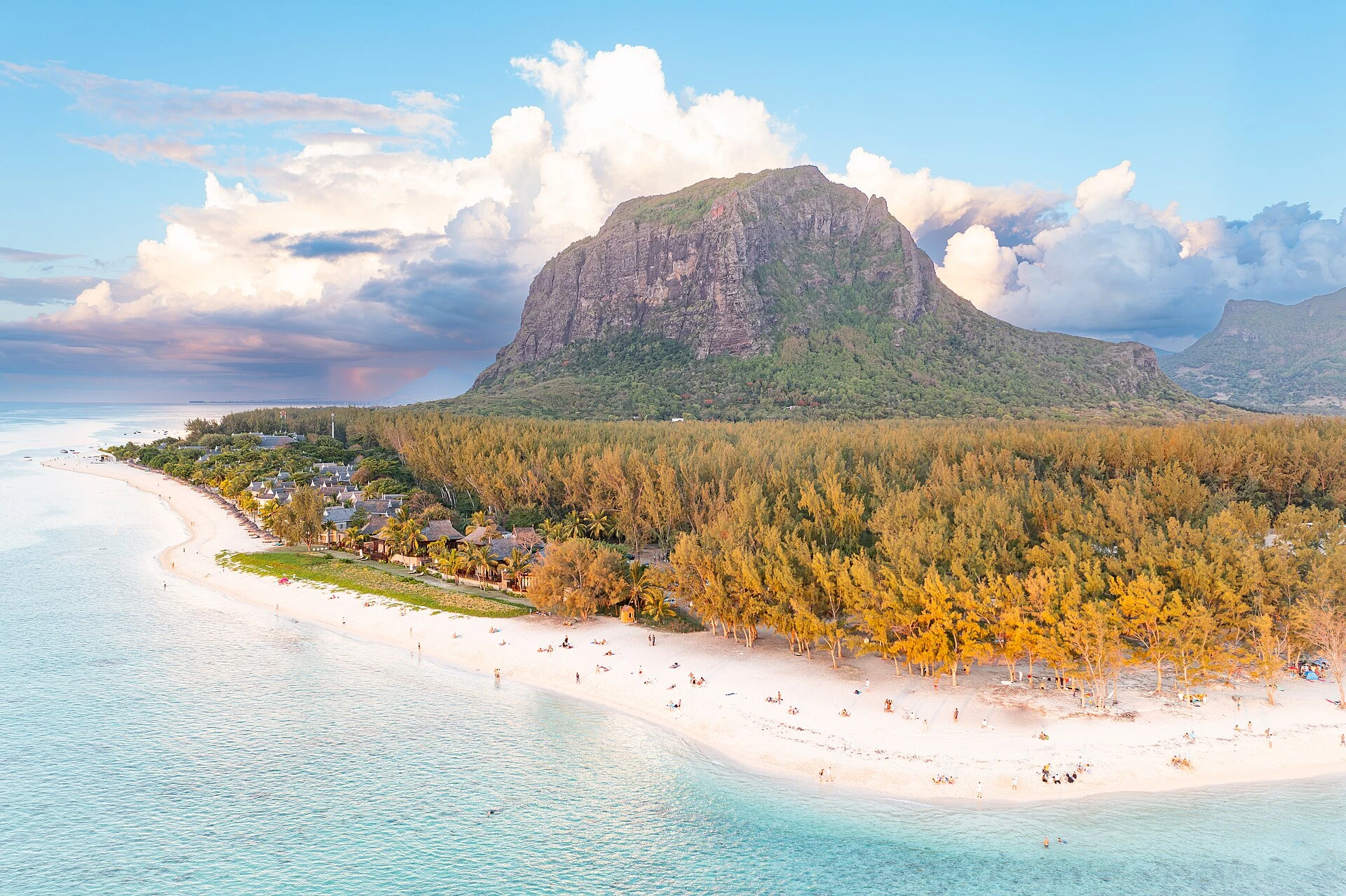
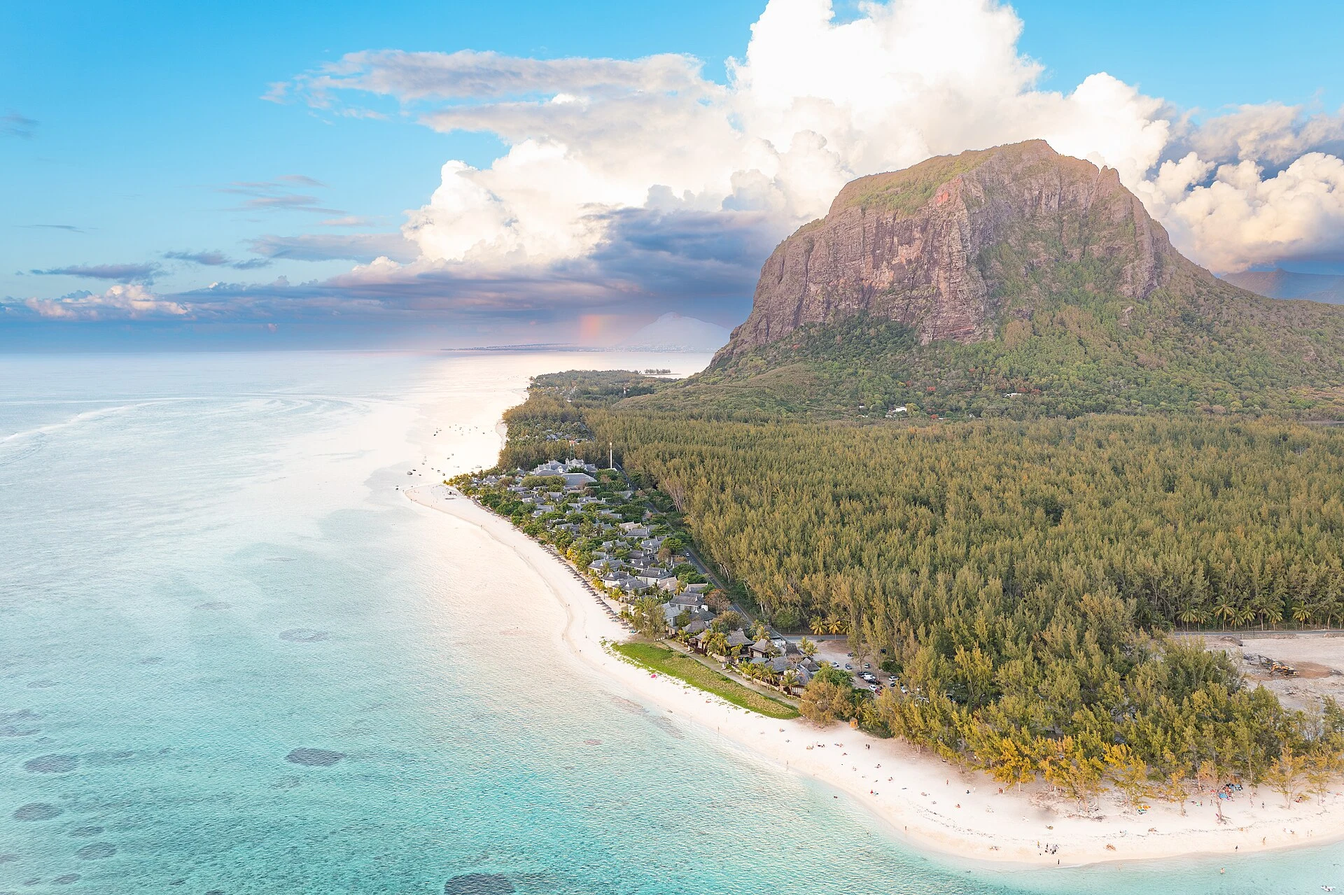
Le Morne Cultural Landscape, in southwestern Mauritius, is not simply a generic viewpoint over a lagoon and reef. UNESCO recognises it for its tangible and oral links to marronage: the mountain served as a refuge for enslaved people who escaped, and it remains a symbol of resistance to slavery and the struggle for freedom. The best visit is not necessarily the one that chases a photograph from the summit, but the one that chooses a scale and pace suited to the terrain, the time available and the commemorative character of the site.
First decide what you have come to do: walk or understand
The most useful decision is made before you put on your hiking boots. If history is your priority, allow time for the International Slave Route Monument and the Trou Chenille Open Air Museum, near the mountain entrance. Trou Chenille interprets the life of a former community established after the abolition of slavery in 1835; the institution responsible presents it as the living memory of a population descended from enslaved people, not as an isolated stage set.
If you want to hike, treat the ascent as a complementary activity, not as proof that you have “done” Le Morne. The mountain is part of a protected 349.6-hectare cultural landscape, with a much larger buffer zone encompassing the peninsula and lagoon; reducing it to its silhouette or the supposed “underwater waterfall” erases precisely the relationship between mountain, coast, memory and community that UNESCO’s inscription protects.
The real choice is between Section 1 and Section 2
The official trail has two distinct characters. The first section reaches the initial plateaus and viewpoints; it is the sensible option for anyone who wants to read the landscape without taking on a steeper stretch. The second section demands more: there is loose rock, a risk of falling stones and greater exposure. The Le Morne Heritage Trust Fund expressly states that you should not continue in rain or strong winds, if you are not physically fit, if heights make you uncomfortable, if you lack suitable equipment or if you do not know the route. To enter this section, you must complete the waiver form provided by security staff.
Do not confuse the authorised endpoint with the geographical summit. The visitor route ends at the metal cross, at an altitude of 492 metres; official guidance is not to climb beyond it. This matters both for safety and out of respect for a site of memory and conservation. If your group includes children under 13, the Trust Fund itself advises against taking them up Section 2.
A responsible visit does not require treating a legend as fact
Le Morne is closely linked to powerful oral traditions about suffering, sacrifice and freedom. They should be heard without turning them into a simplified tourist narrative. UNESCO’s dossier confirms archaeological, documentary and oral evidence of maroon communities on the mountain and its slopes. It also explains that the repeated story of people throwing themselves directly from the mountain into the sea is a persistent legend: the document notes that such a jump is not physically possible from the mountain to the sea.
Precision does not lessen the gravity of slavery or Le Morne’s symbolic power; instead, it prevents historical suffering from being consumed as a spectacular anecdote. Use terms such as enslaved people, maroon communities or resistance when speaking about the site, avoid posing on monuments, and give interpretive time the same weight as the walk.
Allow plenty of time and check what can change
Access must be through the official trailhead, and visitors are required to record both their arrival and departure in the visitor register. Information published by the Trust Fund sets 14:30 as the latest time to begin the ascent and asks visitors to be back at the entrance by 16:00; it also provides for closures in response to heavy-rain warnings, cyclones, rockfalls or other hazards. Check the official notice on the day itself: improvement works to access routes, drainage, signage and visitor-flow management announced by the Ministry of Arts and Culture may alter conditions on the ground.
Bring water, sun protection, grippy footwear and a backpack that leaves your hands free if you decide to continue into the upper section. This is not a suitable route for a wheelchair or for anyone who needs a stable, continuous surface; in that case, focus your visit on the memorial elements at the foot of the mountain and ask locally which areas are accessible that day. If you are travelling without a car, a regional bus route passes through Le Morne, but frequencies, stops and timetables can change: check the current transport authority schedule before relying on it for an ascent with a time limit.
One way to structure the day
Arrive with enough time to begin at the monument and Trou Chenille. Then decide whether to climb after looking at the sky, the state of the ground and how everyone in the group is feeling: the first plateau already offers a full mountain-and-lagoon experience, and there is no obligation to continue to Section 2. On the way down, return the site to a human scale: leave no litter, do not create shortcuts, throw stones or occupy limited-capacity viewpoints for too long. The Trust Fund explicitly asks visitors to respect signs, rest areas and the capacity of the cross area.
References consulted during editorial review. Times, requirements and advisories may change: always confirm with the official source.
- https://lemorneheritage.govmu.org/lmh/wp-content/uploads/2024/06/General-practical-information.pdflemorneheritage.govmu.org
- https://lemorneheritage.govmu.org/lmh/wp-content/uploads/2023/07/General-practical-information.pdflemorneheritage.govmu.org
- https://lemorneheritage.govmu.org/lmh/lemorneheritage.govmu.org
- https://npcs.govmu.org/Pages/National%20Parks/Black-River-Gorges-National-Parks.aspxnpcs.govmu.org
- https://lemorneheritage.govmu.org/lmh/wp-content/uploads/2023/07/LMCL-WHS-2019-English.pdflemorneheritage.govmu.org
- https://culture.govmu.org/mach/?p=6982culture.govmu.org
- https://hikingmauritius.org/hikes/le-morne-brabanthikingmauritius.org
- https://hikingmauritius.org/planning/guided-or-self-guidedhikingmauritius.org
- MauricioWikidata · CC0 1.0 · Wikidata · Q2880923
- MauricioWikidata · CC0 1.0 · Wikidata · Q1027
- MauricioWikidata · CC0 1.0 · Wikidata · Q37539330
- MauritiusWorld Countries — mledoze · ODbL 1.0 · World countries dataset by mledoze and contributors · ODbL 1.0
- MauritiusWorld Bank Open Data · CC BY 4.0 · World Bank
- Impactos del Turismo en Amatlán de Quetzalcóatl: organización comunitaria frente a la turistificaciónCrossref · Metadatos públicos; derechos específicos por campo cuando correspondan · Crossref