Spain · Catalonia · La Garrotxa Volcanic Zone Natural Park
La Garrotxa’s volcanic centre by landscape, time and transport
You do not need to combine La Fageda d’en Jordà, Santa Margarida and Croscat in a single day. The best choice depends on whether you want to understand the landscape, really walk, or arrive without a car.
Conditions described in the guide: confirm current requirements and access with the official source before travelling.
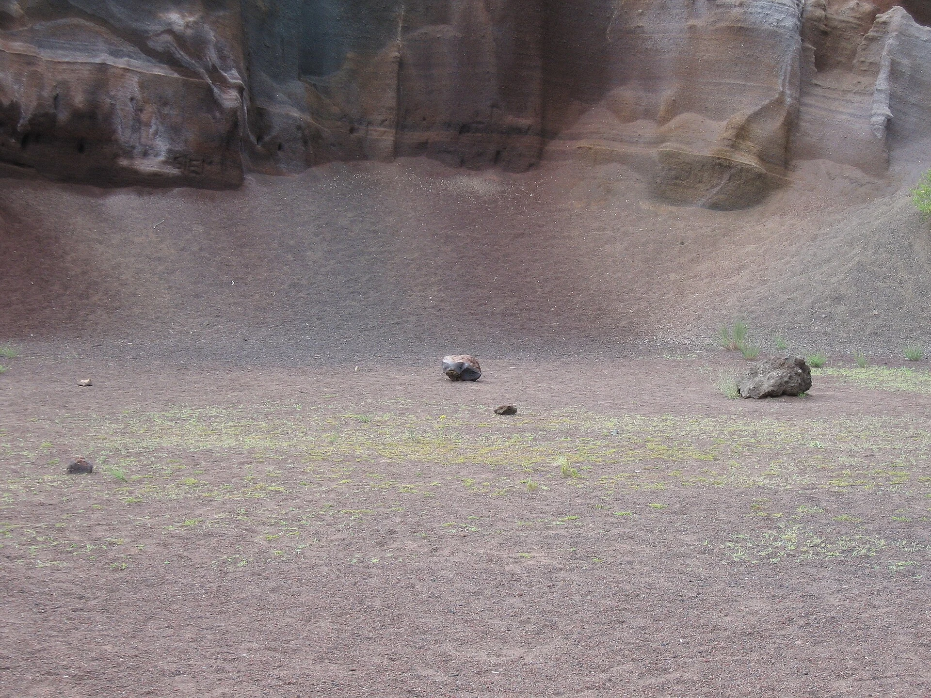
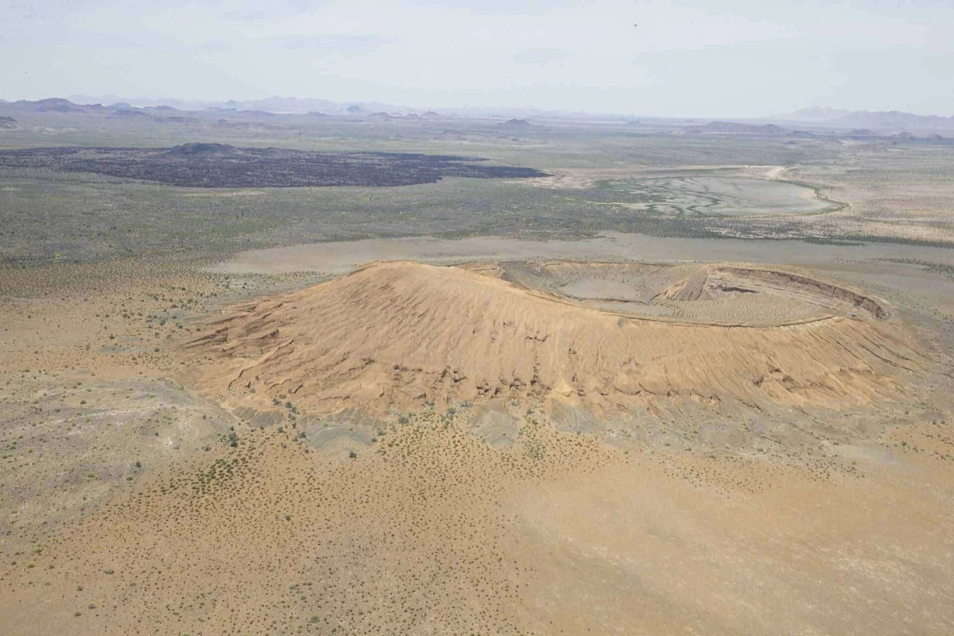
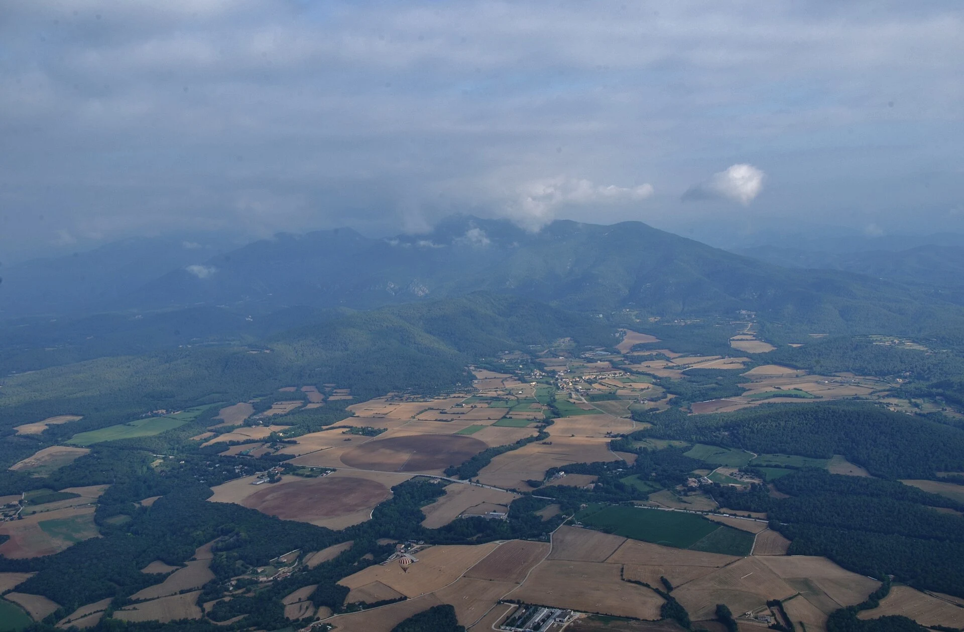
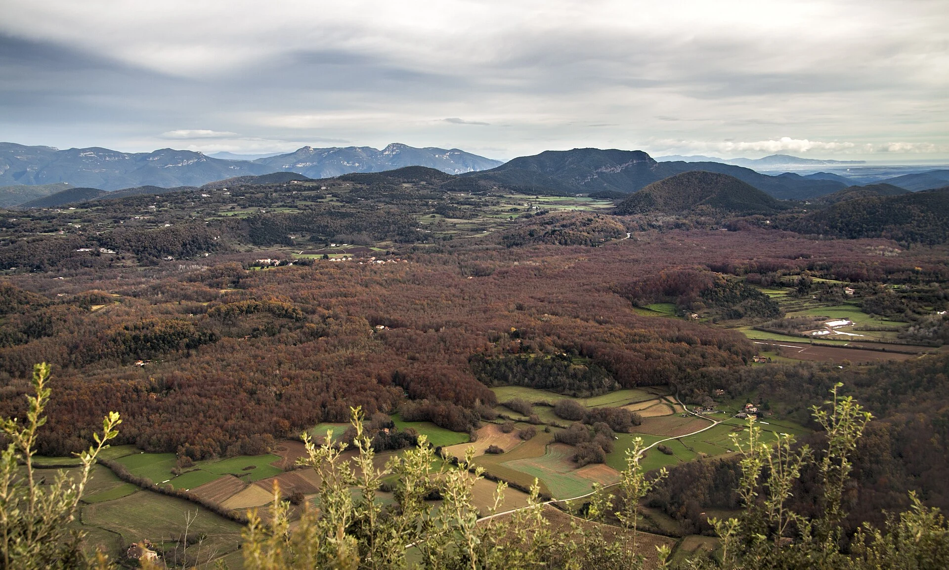
The heart of La Garrotxa Volcanic Zone Natural Park seems designed for a quick visit: a beech forest, two volcanoes and a medieval village linked by the road between Olot and Santa Pau. But these places do not explain the same things or require the same effort. The beech forest lets you read a lava flow from within; Santa Margarida presents a broad, humanised crater; Croscat, by contrast, reveals the exposed section of a volcanic cone altered by former quarrying.
The useful question is not how many names you can fit on the map, but at what pace you want to understand them. These three proposals prevent you from confusing a short walk with a moderate hike—or a public-transport excursion with a day that depends on a car—and leave room to stop where the landscape truly changes.
Listen to Spain
A documented soundscape that complements this guide to Spain. You do not need to combine La Fageda d’en Jordà, Santa Margarida and Croscat in a single day. The best choice depends on whether you want to understand the landscape, really walk, or arrive without a car.
Audio by kevp888 · Openverse · CC BY 4.0 · Duration: 02:26
First, decide which landscape should lead the day
Choose La Fageda d’en Jordà if you have little time or want an easy walk. The Joan Maragall trail crosses a beech forest growing on the Croscat lava flow. It is the most concentrated option: the aim is not a crater panorama, but to notice the uneven relief of the tossols, small rises created when lava solidified over wet ground. It is a good choice for a relaxed morning, for travelling with children who are used to walking, or for combining nature with Olot.
Choose Santa Margarida if you are interested in the volcano’s shape. The experience here is more open: you descend into an explosion crater and clearly understand that the park is not a mountain backdrop, but volcanic territory. It should not be presented as a route without elevation change: reaching the crater and climbing back out means walking on natural ground and managing the uphill return.
Choose Croscat if you want to read the geology as well as a history of protection. Its great cut through reddish earth is not just another “viewpoint”: it exposes the cone’s materials and recalls that the site was affected by extraction before its recovery. Access to the clay quarries depends on the museum space’s opening arrangements and hours; check them before planning your route around this point.
Three sensible ways to organise the day
1. A woodland walk, without chasing summits. Enter via Can Serra and limit the outing to La Fageda d’en Jordà. Allow time to walk slowly and retrace your steps; the value lies in the volcanic ground, the light beneath the beech trees and the change in texture, not in adding kilometres. This option makes sense if the weather is unsettled, you arrive late or you need a day compatible with other plans in Olot.
2. A volcanic circuit for those who do want to walk. The circular itinerary linking La Fageda, Santa Margarida and Croscat is about 10.9 kilometres long, with roughly 290 metres of elevation gain, and is classified as moderate. The park estimates around 3 hours and 15 minutes of walking, but an attentive visit—with breaks, authorised detours and time at the information centre—requires more leeway. It is the best formula for a first comprehensive visit, provided you wear hiking footwear and do not treat it like an urban stroll.
3. A crossing between Olot and Santa Pau. If you do not want to drive, or would prefer the landscape to unfold continuously, the signed section between Olot bus station and Santa Pau connects the city, La Fageda and the volcanic area before ending in the village. It is about 13 kilometres, with around 300 metres of elevation gain and an indicative walking time of four hours. Its advantage is that it turns the journey itself into the route; the logistical cost is that you must decide in advance how you will return and should not rely on timetables that may vary by season, weekend or public holiday.
Do not make Santa Pau the automatic finish
Santa Pau works best as the end of the crossing rather than simply a place to stop for lunch after parking beside a volcano. Its historic centre gives a human scale to a landscape that has been agricultural, forested and inhabited, and lets you finish the walk without immediately returning to a road or car park.
If you do the central circuit from Can Serra or Santa Margarida, add Santa Pau only if you genuinely have the energy and time: the detour changes the character of the day. If you take the linear route from Olot, by contrast, the village is a coherent destination. This difference matters especially on short days, in the rain or when travelling with people who do not enjoy a prolonged walk.
Mobility: the car solves one problem and creates another
The two main car parks make it easy to reach La Fageda and the Croscat–Santa Margarida axis, but they concentrate visitors during the middle of the day. If you drive, arriving early is not a strategy for “getting a space”, but for spreading out the visit and walking before the best-known sections become busier.
The alternative is Rumbus, the service linking Les Preses, Olot and Santa Pau, with stops in the central area. It is particularly useful for planning the Olot–Santa Pau crossing or avoiding moving the car between nearby points. Check the current timetable, active stops, fares, bicycle conditions and any service changes in the official information.
People with reduced mobility should not assume that the volcanic trails are independently accessible: there are roots, slopes, uneven surfaces and natural sections. The park provides specific support and authorisations in certain cases, but these must be requested and confirmed in advance; describe your particular needs before travelling.
Responsible visiting here is very specific
Do not leave the marked itineraries to look for better angles of the crater or clay quarries. Much of the park lies on private property, and the most visited reserves require movement to remain on the designated paths. Take your waste with you, do not collect rocks or volcanic materials, and avoid unnecessary noise: the landscape is easier to understand without adding a soundtrack.
If you travel with a dog, keep it on a lead. Camping is not permitted inside the park, and drone use requires express authorisation. For large groups, organised activities, photo sessions or any proposal that goes beyond an individual visit, check in advance whether you need a permit. These are small gestures, but they prevent a protected, lived-in territory from becoming a fast-consumption circuit.
Before setting out: what to check and where
Opening hours for the Croscat museum space, trail conditions, weather warnings, temporary restrictions and visiting rules must be checked in the updated information from La Garrotxa Volcanic Zone Natural Park. Consult the information there for itineraries 1, 3A and 15, as well as the guide map.
To choose between car and public transport, check the Rumbus service in the information provided by Turisme Garrotxa, including any timetable changes. This organisation also gathers current guidance on car parks, busiest periods and accessibility resources.
For institutional information about the connection between Olot, Les Preses and Santa Pau, consult the mobility information from Olot Town Council. Confirm the service operating on the exact date of your visit before basing a linear route on the bus.
References consulted during editorial review. Times, requirements and advisories may change: always confirm with the official source.
- https://parcsnaturals.gencat.cat/es/xarxa-de-parcs/garrotxa/gaudeix-del-parc/equipaments-i-itineraris/itineraris/num1/parcsnaturals.gencat.cat
- https://parcsnaturals.gencat.cat/web/.content/Xarxa-de-parcs/garrotxa/coneix-nostra-feina/centre-documentacio/estudis/educacio-ambiental/EM-cartelleres/2023/planol-it-pn.pdfparcsnaturals.gencat.cat
- https://parcsnaturals.gencat.cat/ca/xarxa-de-parcs/garrotxa/gaudeix-del-parc/equipaments-i-itineraris/itineraris/num1/parcsnaturals.gencat.cat
- https://parcsnaturals.gencat.cat/web/.content/Xarxa-de-parcs/garrotxa/gaudeix-parc/equipaments-itineraris/itineraris/a-peu/03A.PNZVG-OLOT-BUS-STA-PAU-cast.pdfparcsnaturals.gencat.cat
- https://parcsnaturals.gencat.cat/web/.content/Xarxa-de-parcs/garrotxa/coneix-nostra-feina/centre-documentacio/estudis/itineraris/12_lugares_interes.pdfparcsnaturals.gencat.cat
- https://parcsnaturals.gencat.cat/es/xarxa-de-parcs/garrotxa/gaudeix-del-parc/equipaments-i-itineraris/itineraris/num3b/parcsnaturals.gencat.cat
- https://parcsnaturals.gencat.cat/web/.content/Xarxa-de-parcs/garrotxa/gaudeix-parc/equipaments-itineraris/itineraris/a-peu/01.PNZVG-CIRCULAR-cast.pdfparcsnaturals.gencat.cat
- https://parcsnaturals.gencat.cat/en/xarxa-de-parcs/garrotxa/gaudeix-del-parc/equipaments-i-itineraris/itineraris/index.htmlparcsnaturals.gencat.cat
- EspañaWikidata · CC0 1.0 · Wikidata · Q29
- EspañaWikidata · CC0 1.0 · Wikidata · Q2565342
- EspañaWikidata · CC0 1.0 · Wikidata · Q47450851
- EspañaWikidata · CC0 1.0 · Wikidata · Q16254367
- SpainWorld Countries — mledoze · ODbL 1.0 · World countries dataset by mledoze and contributors · ODbL 1.0
- SpainWorld Bank Open Data · CC BY 4.0 · World Bank
- SpainDBpedia · CC BY-SA 3.0 · DBpedia
- Evolución de la Industria del Turismo Sostenible en EspañaOpenAlex · CC0 1.0 · OpenAlex
- TURISMO RURAL EN ESPAÑA: PAISAJES Y USUARIOS, NUEVOS USOS Y NUEVAS VISIONESOpenAlex · CC0 1.0 · OpenAlex
- Turismo pos-COVID-19: Reflexiones, retos y oportunidadesOpenAlex · CC0 1.0 · OpenAlex
- Análisis de la oferta de turismo cultural en EspañaOpenAlex · CC0 1.0 · OpenAlex
- HISTORIA DE ALGUNAS DENOMINACIONES DE TURISMO EN ESPAÑA: TURISMO DEPORTIVO, TURISMO CULTURAL, TURISMO MARINERO Y TURISMO GASTRONÓMICOCrossref · Metadatos públicos; derechos específicos por campo cuando correspondan · Crossref
- Fuentes Vega, Alicia: Bienvenido, Mr Turismo. Cultura visual del boom en España. Madrid, Cátedra, 2017. 333 pp.Crossref · Metadatos públicos; derechos específicos por campo cuando correspondan · Crossref
- Discontinuidades y limitaciones de los últimos planes turísticos de España en relación a la sostenibilidad ambiental del turismo de sol y playaCrossref · Metadatos públicos; derechos específicos por campo cuando correspondan · Crossref