Rocha, Uruguay
Cabo Polonio Access from Route 10 or Barra de Valizas
In Cabo Polonio, the way in shapes the experience. Compare the authorized transfer from Route 10 with the walk from Barra de Valizas, and choose according to your time, luggage and tolerance for sand.
Conditions described in the guide: confirm current requirements and access with the official source before travelling.
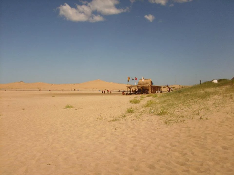
Cabo Polonio is not organized around a road that reaches the center of the settlement: the final stretch is an essential part of the visit. From the Polonio Entrance, authorized vehicles cross the dune system; from Barra de Valizas, a walking route involves crossing the stream and continuing along the beach, dunes and Cerro de la Buena Vista. These are not two equivalent versions of the same transfer: one saves energy and fixes the day’s schedule; the other turns the arrival into a walk across changing terrain.
The most useful decision is a simple one. Choose the 4x4 if you have little time, bulky luggage or young children, or if you want to save your energy for exploring the cape. Choose Valizas only if you are looking for a full day of walking, can carry water and sun protection, and accept that the stream crossing and wind will affect your pace.
Listen to Uruguay
A documented soundscape that complements this guide to Uruguay. In Cabo Polonio, the way in shapes the experience. Compare the authorized transfer from Route 10 with the walk from Barra de Valizas, and choose according to your time, luggage and tolerance for sand.
Audio by ninoing · Openverse · CC BY 4.0 · Duration: 00:33
Two access points, two different days
The Polonio Entrance is on Route 10, at kilometer 264.5. From there, the authorized transfer travels about 7 kilometers to the settlement. It is the most direct option and the right choice for anyone staying in Cabo Polonio: you can arrive with your belongings without turning the entrance into a trek.
Access from Barra de Valizas follows a different logic. Self-guided trails connect the Valizas area with Cabo Polonio; the longest published route to Playa de las Calaveras covers 10 kilometers and is estimated to take three hours. It includes Cerro de la Buena Vista, soft sand and prolonged exposure to sun and wind. Do not treat it as a shortcut or as an activity to improvise after a morning at the beach.
An intermediate alternative is to walk from Valizas to the hill and return the same way. This lets you experience the dune landscape without having to complete the crossing to Cabo Polonio or coordinate a return from another point.
The Valizas Stream Is a Condition, Not a Detail
To leave Barra de Valizas heading south, you must deal with the stream crossing. Conditions change, and local boats are available when appropriate. Do not count on wading across on your own or attempting to swim across.
Before starting the walk, check in Valizas whether a boat is operating, its hours of operation, and the current conditions of the stream and wind. This check matters more than a generic estimate of the duration. If the crossing is unavailable or the group is not comfortable with a long route over sand, change your plan and enter through the Polonio Entrance.
For the crossing, bring footwear suitable for both sand and rock, enough water for the entire route, a hat, sunscreen, a charged phone and a windproof layer. Keep the itinerary straightforward: dunes are not a place for creating off-trail alternatives outside marked routes.
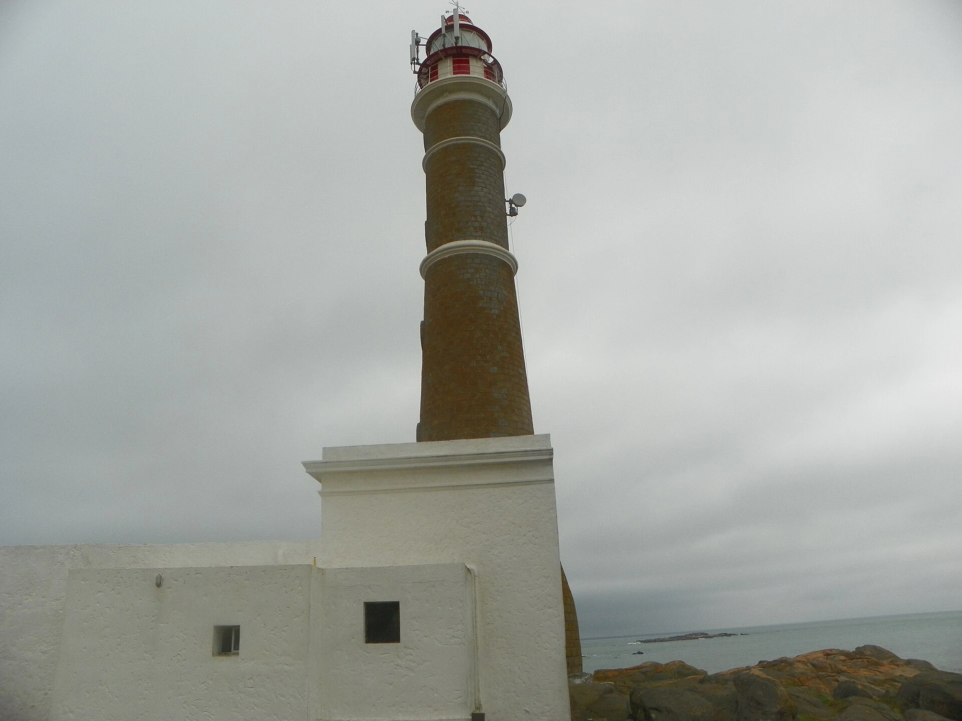
A Visit That Begins in the Dunes and Continues by the Sea
The National Park brings together dunes, coastline, islands and a small-scale settlement. Arriving by 4x4 helps make clear that the vehicle is a regulated access tool, not an invitation to drive freely along the beach. Private vehicles may not enter the protected area.
Once at the cape, it is best to walk with a specific goal: connect Playa Sur, the lighthouse area and Playa de la Calavera. The rocky point is a prime place for observing fur seals and sea lions, but it should not be understood as a place to approach wildlife. Some fragile areas have specific restrictions to protect the animals; observe from designated places, do not feed them, and avoid noise, drones and pets.
The settlement also requires everyday planning. Its infrastructure is limited and does not follow the pattern of a resort connected by conventional roads and services. Before leaving Route 10, confirm directly with your accommodation what water, power, food, payment methods and arrival arrangements it provides.
The Best Combination for a First Visit
For a first night, the most balanced approach is usually to enter through the Polonio Entrance and leave the Valizas walk as a separate excursion or as a return journey, but only if conditions and stream-crossing logistics allow it. This way, arriving with luggage does not become the most demanding part of the trip.
If walking is your priority, base yourself in Barra de Valizas, set out early and consider the route to Cabo Polonio a full-day outing. Decide in advance how you will return: completing the route does not guarantee that you will coincide with the departure vehicles’ schedule or with boat-crossing availability.
Avoid treating the park as a place to rush through. Walking on established paths, taking all waste with you and adapting your plan to actual conditions help ensure that your visit fits a mobile and ecologically sensitive landscape.
Before You Leave: What to Check
The schedules of the access and departure vehicles, the frequency of buses reaching the Polonio Entrance, boat availability for the crossing at Valizas, weather and stream conditions, and the services actually provided by each accommodation are all variable. Check them on the same day or sufficiently in advance through official channels and with the relevant provider.
Also confirm the current rules on bringing pets, camping, movement through the protected area and access to wildlife sectors. Do not base these decisions on old social-media posts or other travelers’ experiences.
Official Sources to Check Before You Leave
- Ministry of Environment — Cabo Polonio National Park and National Environmental Observatory: boundaries of the protected area, conservation values, permitted access and management regulations.
- Rocha Tourism — Polonio Entrance: operating hours for the authorized transfer, entry rules and notices of changes. Always check the most recent update.
- Rocha Tourism — Self-Guided Dune and Cerro de la Buena Vista Trails: approximate distances, duration, equipment recommendations and coordination of the Valizas Stream crossing.
- Uruguay Natural — Cabo Polonio: park context, general access options and protected ecosystems.
References consulted during editorial review. Times, requirements and advisories may change: always confirm with the official source.
- https://www.gub.uy/ministerio-ambiente/comunicacion/publicaciones/plan-manejo-del-parque-nacional-cabo-poloniowww.gub.uy
- https://www.gub.uy/ministerio-ambiente/sites/ministerio-ambiente/files/documentos/publicaciones/Plan-de-Manejo-PN-Cabo-Polonio_compressed%281%29.pdfwww.gub.uy
- https://turismorocha.gub.uy/horarios-cabo-polonioturismorocha.gub.uy
- https://www.gub.uy/ministerio-ganaderia-agricultura-pesca/comunicacion/publicaciones/normativa-pesca-artesanal/normativa-pesca-artesanal/resoluciones-0www.gub.uy
- https://www.ambiente.gub.uy/biblioteca/index.php?id=19492&lvl=notice_displaywww.ambiente.gub.uy
- https://www.ambiente.gub.uy/oan/snap/cabo-polonio/www.ambiente.gub.uy
- https://www.gub.uy/ministerio-ambiente/politicas-y-gestion/parque-nacional-cabo-polonio-rochawww.gub.uy
- https://www.rocha.gub.uy/portal/index.php?id=378www.rocha.gub.uy
- UruguayWikidata · CC0 1.0 · Wikidata · Q77
- UruguayWikidata · CC0 1.0 · Wikidata · Q43298999
- UruguayWorld Countries — mledoze · ODbL 1.0 · World countries dataset by mledoze and contributors · ODbL 1.0
- UruguayWorld Bank Open Data · CC BY 4.0 · World Bank
- UruguayDBpedia · CC BY-SA 3.0 · DBpedia
- Hacia un manejo ecosistémico de pesquerías. Áreas marinas protegidas en UruguayOpenAlex · CC0 1.0 · OpenAlex
- Parajes costeros, turismo y paisajes culturales en UruguayCrossref · Metadatos públicos; derechos específicos por campo cuando correspondan · Crossref
- “Esto es Uruguay”. Turismo, fotografía e imaginario nacional durante la dictadura uruguaya. (1975—1983)Crossref · Metadatos públicos; derechos específicos por campo cuando correspondan · Crossref