Orkney Islands · Scotland
Neolithic Orkney from Maeshowe to Skara Brae
A two-day visit that connects tomb, ceremonial circles and settlement without reducing western Mainland to a sequence of stops.
Conditions described in the guide: confirm current requirements and access with the official source before travelling.
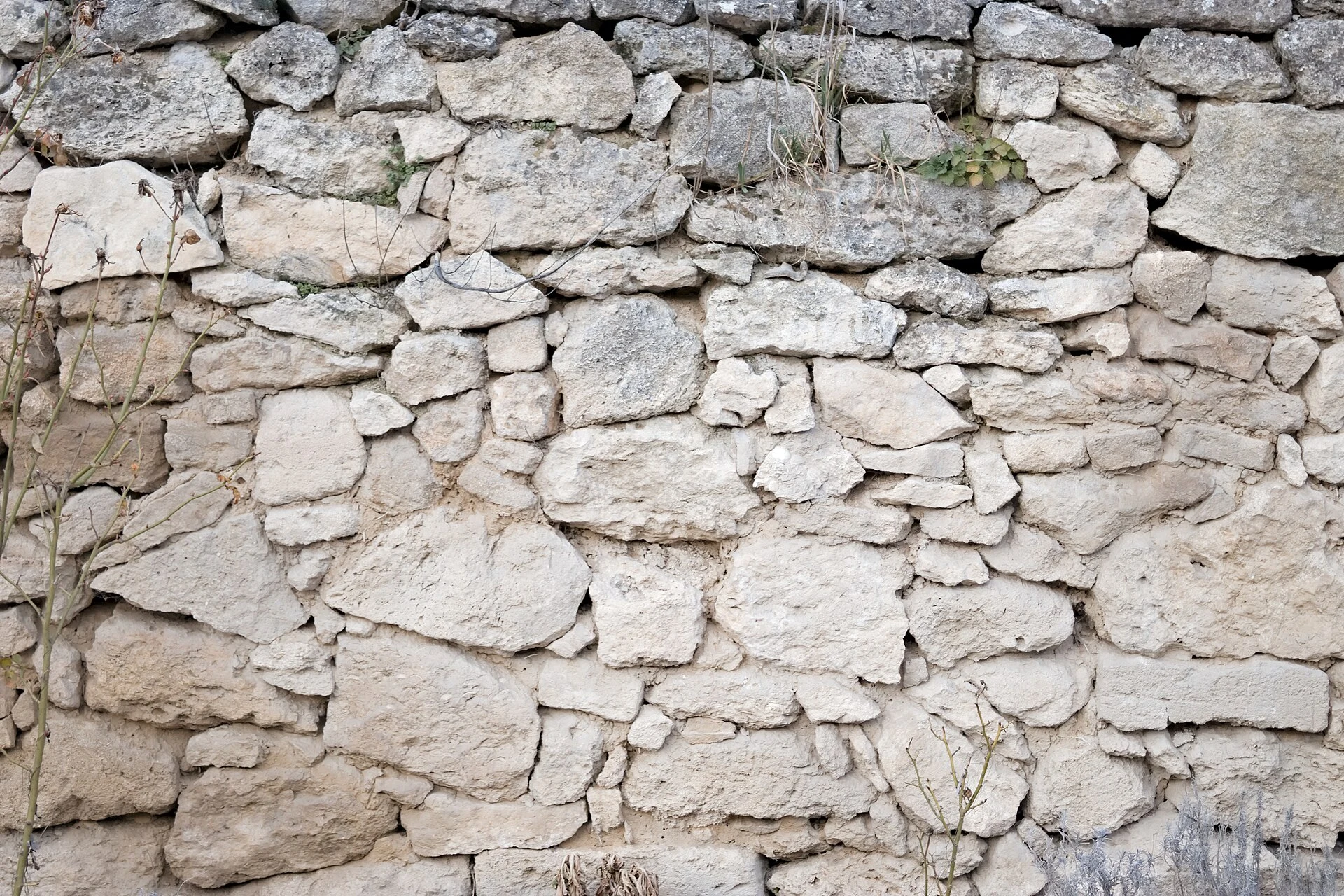
The Heart of Neolithic Orkney is not a collection of isolated monuments: Maeshowe, the Standing Stones of Stenness, the Ring of Brodgar and Skara Brae make sense as parts of the same inhabited, ceremonial and funerary landscape. Making Maeshowe the main focus and allowing time to walk around Stenness and Brodgar helps you understand the scale of the area before reaching the settlement. For a first visit, two days in western Mainland are a more sensible choice than trying to link everything from Kirkwall in a single day.
Four places, three ways of approaching the Neolithic
Begin with Maeshowe, a chambered tomb visited by guided tour. The experience is deliberately contained: you travel by shuttle from the visitor centre, walk to the mound and enter through a low, narrow passage. It is not interchangeable with the other stops; it is best placed at the beginning because it prompts you to think about orientation, construction and ritual before looking out across the open landscape.
The Standing Stones of Stenness and the Ring of Brodgar offer a different scale. There is no single interpretation that settles their meaning: their value also lies in their relationship with the lochs, embankments, paths and other unexcavated remains in the surrounding area. Follow the marked paths, respect one-way systems when they are in operation, and do not turn the circle into a backdrop for cutting across the site.
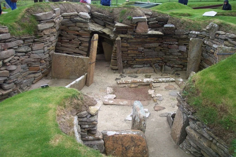
Leave Skara Brae for the second day. Its preserved houses and stone furniture shift the focus from ceremonial monumentality to domestic questions: how an interior was organised, what it meant to live beside the coast and why conserving this place requires regulated access. The visitor centre provides that context; the village is viewed from established routes, not from inside the original houses.
A two-day structure that leaves room for the landscape
On the first day, schedule your Maeshowe tour and use the rest of the day for Stenness and Brodgar. The territory between the two circles deserves to be explored slowly, not merely photographed from a car park. Bring clothing for wind and rain, water and some spare time: the exposed terrain is part of the experience and also affects your pace.
The second day is for Skara Brae and the Sandwick coast. The route between the visitor centre and the settlement is about 500 metres along a prepared path, but the archaeological circuit includes narrow stretches, steps, and stone and grass surfaces. If domestic archaeology is your main interest, allow more time here than for a quick visit to the circles.
This arrangement has a practical advantage: it separates timed admissions from open-air sites. It also prevents you from treating Brodgar and Stenness as a break on the way to Skara Brae, when they are essential to understanding the archaeological density of the area.
Travelling without a car means accepting fewer detours
Public transport connects Kirkwall and Stromness with western Mainland, and in summer some services run close to the main archaeological sites. It is a viable option without a car if you choose only a few objectives, check the current timetable and accept that connections determine the length of your day. Do not plan a chain of remote stops based on assumed frequencies.
A car gives you more flexibility to combine Skara Brae with Birsay, mounds or small chambered tombs, but it is not essential for the core of this itinerary. The trade-off of taking the bus is a positive one: it forces you to choose, walk and pay attention to the landscape instead of multiplying points on a map.
Accessibility deserves an informed decision. The Skara Brae visitor centre has adapted access, although the outdoor visit reaches terrain with varying widths and gradients. At Maeshowe, the shuttle may accommodate a wheelchair depending on its operating conditions, but the mound and passage are not wheelchair accessible. Check these conditions before booking, as well as timetables, bus routes and possible weather-related changes.
Visiting an archaeological landscape that remains vulnerable
Heritage recognition does not remove material fragility. At Skara Brae, the proximity of the sea and coastal erosion are among the reasons access is controlled; across the site, wear caused by footfall also matters. Stay on the paths, do not climb embankments or stones, and avoid leaving waste, including organic waste, in areas without facilities.
The best approach here is to observe before interpreting. The circles and mounds do not need a spectacular explanation to justify a visit: simply comparing a closed tomb, an exposed settlement and two open ceremonial spaces is enough to show that Neolithic life cannot be reduced to a single image.
If wind, rain or transport disrupts your plan, give up the idea of adding another site and return to the landscape you have already chosen. That flexibility is a practical way to travel with less pressure on the place and more attention to what can actually be understood.
Official sources worth checking before you leave
The following resources underpin this guide. Timetables, tickets, accessibility arrangements, shuttle operations and bus services are variable information and should be confirmed directly before travelling.
- Historic Environment Scotland: visit planning, guided access and accessibility conditions for Maeshowe; planning, routes and accessibility at Skara Brae.
- Orkney Islands Council: maps, timetables, service changes and operational notices for public buses.
- UNESCO World Heritage Centre: the boundaries and interpretation of the Heart of Neolithic Orkney, together with the conservation factors affecting the site.
- Orkney.com: regional guidance for western Mainland and information on how transport services connect with the main archaeological sites.
References consulted during editorial review. Times, requirements and advisories may change: always confirm with the official source.
- https://www.historicenvironment.scot/visit/all/skara-brae/plan-your-visit/www.historicenvironment.scot
- https://www.orkneyferries.co.uk/timetableswww.orkneyferries.co.uk
- https://www.historicenvironment.scot/visit-a-place/places/skara-brae/?PropID=PL_244www.historicenvironment.scot
- https://www.orkneyferries.co.uk/documents/summer-2026-outer-north-isleswww.orkneyferries.co.uk
- https://www.orkney.com/site/assets/files/73490/orkney-public-bus-guide-summer-2025-online-and-email.pdfwww.orkney.com
- https://www.orkneyferries.co.uk/documents/winter-2025-26-outer-north-isleswww.orkneyferries.co.uk
- https://www.orkney.gov.uk/our-services/transport/www.orkney.gov.uk
- https://www.orkney.com/explore/west-mainlandwww.orkney.com
- Reino UnidoWikidata · CC0 1.0 · Wikidata · Q145
- United KingdomWorld Countries — mledoze · ODbL 1.0 · World countries dataset by mledoze and contributors · ODbL 1.0
- United KingdomWorld Bank Open Data · CC BY 4.0 · World Bank
- United KingdomDBpedia · CC BY-SA 3.0 · DBpedia
- Aproximación a la historia del turismo en el Reino Unido, siglos XVIII-XXCrossref · Metadatos públicos; derechos específicos por campo cuando correspondan · Crossref
- Ensino superior em turismo: experiência do Reino UnidoCrossref · Metadatos públicos; derechos específicos por campo cuando correspondan · Crossref
- Cultura e pandemia no Reino UnidoCrossref · Metadatos públicos; derechos específicos por campo cuando correspondan · Crossref