Vertical mobility for a car-free visit
Monaco on foot with public lifts and urban gardens
In Monaco, distance can be deceptive: the challenge is not crossing the map but connecting different levels. This route links La Condamine, Monaco-Ville and Monte-Carlo using mechanised passages, buses and green breaks.
Conditions described in the guide: confirm current requirements and access with the official source before travelling.
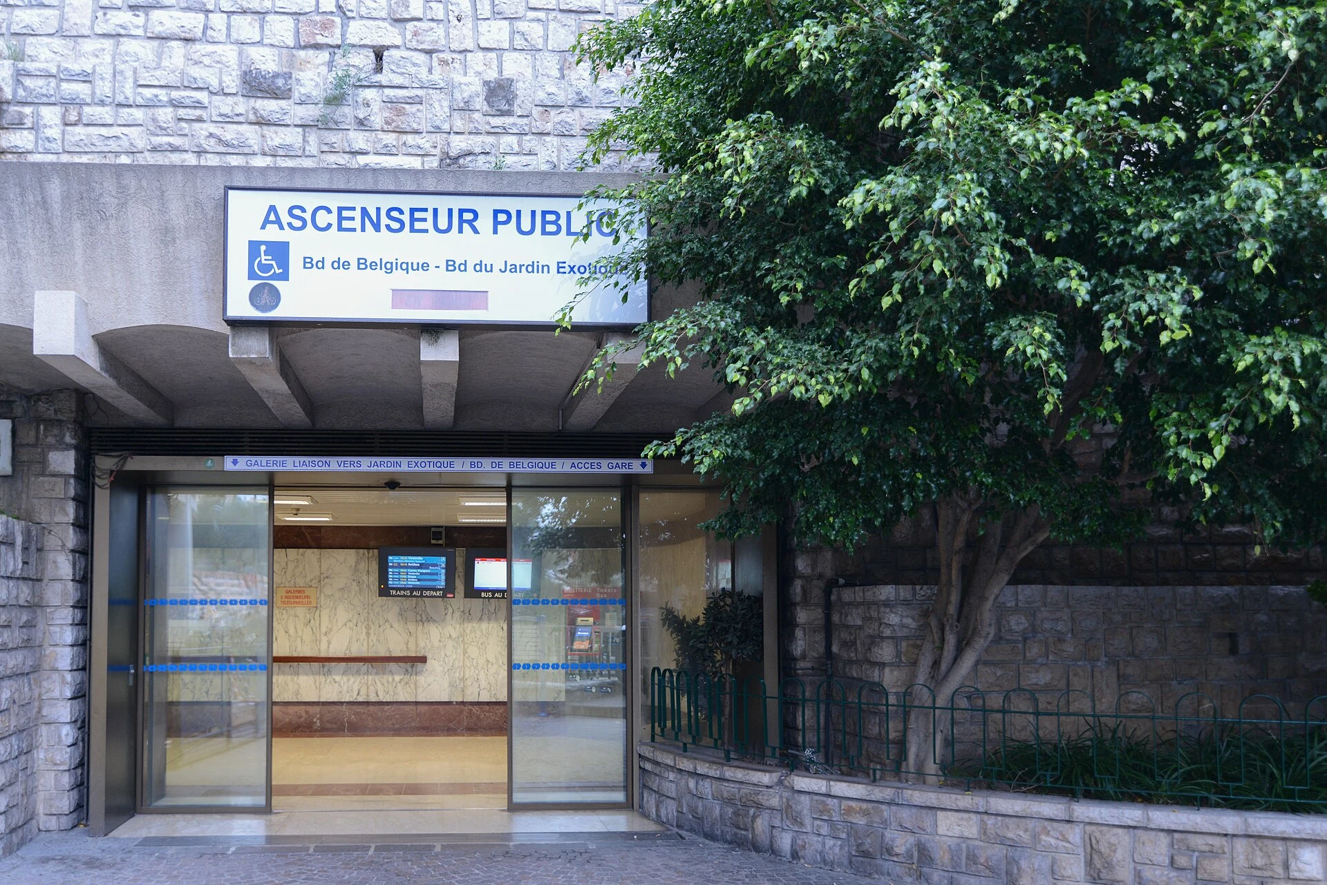
Monaco fits within a small territory, but not within a flat walk. The port, the Rock of Monaco-Ville, the districts of Monte-Carlo and Larvotto are spread across slopes that can turn a short day into a succession of stairs. The best decision is not to try to see everything: organise the day by levels, use public mechanised connections as part of the itinerary and save the walking sections for places where walking adds something.
This proposal is intended for a first car-free day. It combines La Condamine and the port with Monaco-Ville, the Saint-Martin Gardens and the Monte-Carlo area. It is not meant to replace a map: works, lift operation, bus routes and access conditions can change, so check them on the same day.
Think of the city in levels, not neighbourhoods
The station and La Condamine lie in the lower and middle parts of the city; Monaco-Ville rises on the Rock, while Monte-Carlo stretches eastwards at another level. They look close on a map, but the change in elevation determines the actual time, effort and comfort of the route.
Before setting out, download the city’s pedestrian mobility map and mark two alternatives for each climb: one mechanised connection and one bus route. Lifts, escalators and passages are not exceptional shortcuts but everyday infrastructure. Even so, do not assume that they will all be working or that every exit will leave you exactly where you expect: identify the name of the arrival street or neighbourhood, not just the lift symbol.
This approach also avoids a common mistake: going down to the port and immediately climbing back up. Group your visits. Explore one level first, then connect with another and leave time to find your way around the exits of galleries, passages and buildings.
A one-day route from La Condamine to Monte-Carlo
Start in La Condamine, a useful neighbourhood for getting a feel for everyday urban life before reaching the more ceremonial areas. The pedestrianised Princesse Caroline street lets you walk without turning the start of the day into a window-shopping visit; afterwards, the edge of Port Hercule helps explain the relationship between the city, the harbour and the major events that can affect traffic.
From the port area, climb towards Monaco-Ville using whichever option best suits the day: a mechanised connection, the bus or a walk uphill if you feel like it and your mobility allows it. Once there, focus your time on the old town’s streets, the cathedral, the exterior of the Oceanographic Museum and the Saint-Martin and Sainte-Barbe Gardens. These gardens are more than viewpoints: they were the Principality’s first public garden and retain the character of a path on a hillside. Their slopes and curves are more enjoyable at an unhurried pace than as a passage through to somewhere else.
In the afternoon, go down or take a bus towards Monte-Carlo. The Casino Gardens offer a short break between Place du Casino, the Boulingrins and Petite Afrique; they are a calmer way to cross the area than following only the shopping avenues. If you want to continue to Larvotto, treat it as an extension rather than an obligation: it adds travel time and may take time away from the neighbourhoods you are already exploring.
The harbour water bus can be a pleasant connector between two specific shores, but it is neither a sightseeing cruise nor a universal solution for the itinerary. Use it only if its piers and the day’s timetable fit with your next section.
When to walk and when to take the bus
Walk in La Condamine, along the port, within Monaco-Ville and through the gardens: there, a slower pace reveals urban details, viewpoints and transitions between spaces. Use lifts and escalators to deal with changes in level without making them the aim of the day. The bus is especially useful when you need to change levels, when it is hot, when you are carrying luggage or when someone in the group does not want to tackle a succession of ramps and stairs.
The urban network covers the main districts and provides real-time service information through its official app. Carry an accepted payment card or prepare the mobility app before boarding, but check the purchase and validation methods, fares and any possible disruptions immediately before travelling. On race days, during concerts, conferences or other events, a seemingly simple journey may involve a different stop, route or duration.
Do not base the entire day on a single vertical connection. If a facility is out of service, the alternative may involve a long staircase, a detour or a wait for the bus. For anyone with reduced mobility, using a wheelchair, travelling with a pushchair or needing to avoid slopes, the dedicated accessibility map should be the main tool; the presence of public lifts does not make the streets or gardens uniformly accessible.
The practical choice: one concentrated visit or two half-days
A full day works if your aim is to understand the structure of the city and choose only a few indoor visits. If you want to visit museums, enter the Palace, stop for lunch without tight timings or reach Larvotto, divide the plan into two half-days. One can focus on La Condamine, the port and Monaco-Ville; the other on Monte-Carlo and the coastline.
The concentrated option reduces repeated travel and makes it easier to move considerately through an urban space heavily used by residents, workers and visitors. Keep entrances, passages and lifts clear; do not block doorways to take photos; and choose a break in a garden or square rather than extending the route with a journey that adds little context.
Museum opening times, garden or facility access, Palace entry, the water-bus service and transport disruptions are variable details. Confirm them in official sources before deciding the final order.
Official sources to check before setting out
Monaco Tourist and Convention Authority’s tourist map and Monaco Malin guide: locations of public lifts, escalators, pedestrian routes, reduced-mobility areas and connections between districts.
Compagnie des Autobus de Monaco: routes, disruption notices, real-time information, payment methods, validation and water-bus conditions.
Monaco Tourist and Convention Authority, garden routes: background and locations of the Saint-Martin and Sainte-Barbe Gardens, as well as the transport connections indicated for the Monaco-Ville area.
Monaco accessibility guide: slopes marked in the Saint-Martin Gardens and resources for preparing an adapted route. Check that the edition and operational information are still current.
References consulted during editorial review. Times, requirements and advisories may change: always confirm with the official source.
- https://monservicepublic.gouv.mc/en/content/download/26440/file/Reglement%20Urbanisme%20OS%20n%C2%B04482%20du%2013%20sept%202013.pdf?inLanguage=fre-FR&version=2monservicepublic.gouv.mc
- https://www.cam.mc/en/partner-applications/monacobuswww.cam.mc
- https://www.visitmonaco.com/Documents-Site/7495/Plan%20VisitMonaco%20-%202024.pdfwww.visitmonaco.com
- https://www.visitmonaco.com/Documents-Site/Monaco_Malin.pdfwww.visitmonaco.com
- https://www.cam.mc/www.cam.mc
- https://www.cam.mc/en/conditions-generales-de-ventewww.cam.mc
- https://www.cam.mc/en/faqwww.cam.mc
- https://www.cam.mc/en/regular%20routeswww.cam.mc
- MónacoWikidata · CC0 1.0 · Wikidata · Q235
- MonacoWikidata · CC0 1.0 · Wikidata · Q1943982
- MonacoWikidata · CC0 1.0 · Wikidata · Q16861797
- MonacoWorld Countries — mledoze · ODbL 1.0 · World countries dataset by mledoze and contributors · ODbL 1.0
- MonacoWorld Bank Open Data · CC BY 4.0 · World Bank